Weiach / Weiach (Dorfkern) geodata
Weiach / Weiach (Dorfkern) (Zurich) is a section of populated place; located in Switzerland in Europe/Zurich (GMT+2) time zone. With population of 827 people, there are 1475 cities with bigger population in this country. Compared to other cities in Switzerland, 95.3% of cities are located further ↓South; 52.3% of cities are located further ←West and 91.7% of cities have higher elevation than Weiach / Weiach (Dorfkern). Note1
Current local time in Weiach / Weiach (Dorfkern):
07:38 AM, SaturdayDifference from your time zone: hours


Weiach / Weiach (Dorfkern) GPS coordinates[2]
47° 33' 22.392" North, 8° 26' 18.636" East
| Map corner | latitude | longitude |
|---|---|---|
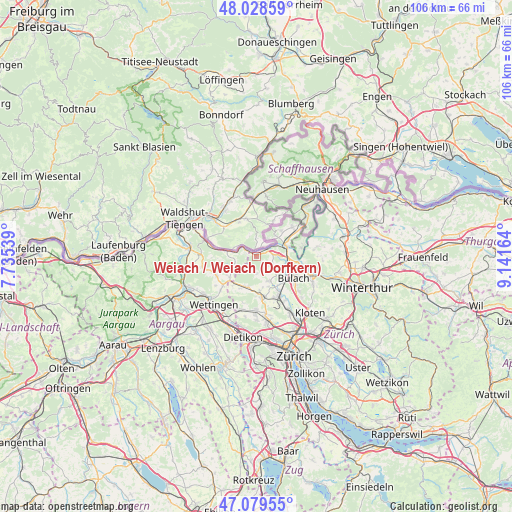
| Upper-left | 48.02859°, | 7.73539° |
| Center: | 47.55622°, | 8.43851° |
| Lower-right: | 47.07955°, | 9.14164° |
| Map W x H: | 105.5×105.5 km | = 65.6×65.6mi |
| max Lat: | 47.76737° ⇑4.7% North |
| Weiach / Weiach (Dorfkern): | 47.55622° |
| min Lat: | ⇓95.3% South 45.83203° |
| min Long | Weiach / Weiach | max Long |
| 5.97153° | 8.43851° | 10.44624° |
| W 52.3%⇐ | ⇒47.7% E |
Elevation
Elevation of Weiach / Weiach (Dorfkern) is 387 m = 1270 ft, and this is 171.2 m = 562 ft below average elevation for this country.
| Max E: |
1845 m = 6053 ft | 91.7% |
| Avg. | 558.2 m = 1831 ft | |
| Weiach / Weiach (Dorfkern) | 387 m = 1270 ft | |
Min E: |
197 m = 646 ft | 8.3% |
See also: Switzerland elevation on elevation.city.
Geographical zone
Weiach / Weiach (Dorfkern) is located in North temperate zone (between Tropic of Cancer and the Arctic Circle). Distance of this North polar circle is 2113.4 km =1313.2 mi to North.| Distance of | km | miles | from Weiach / Weiach (Dorfkern) |
|---|---|---|---|
| North Pole | 4719.3 | 2932.4 | to North |
| Arctic Circle | 2113.4 | 1313.2 | to North |
| Tropic Cancer | 2681.8 | 1666.4 | to South |
| Equator | 5287.8 | 3285.7 | to South |


Nearby cities:
15 places around Weiach / Weiach (Dorfkern): (largest is in red/bold)
• Eglisau
6.6 km =4.1 mi,  69°
69°
• Glattfelden
4.7 km =2.9 mi,  86°
86°
• Hochfelden
6.9 km =4.3 mi,  122°
122°
• Hüntwangen
5.9 km =3.7 mi,  41°
41°
• Neerach
5.6 km =3.5 mi,  154°
154°
• Oberweningen
6.4 km =4 mi,  201°
201°
• Riedt
6.6 km =4.1 mi,  158°
158°
• Seglingen
6.4 km =4 mi, 73°
• Seglingen / Ober-Seglingen
6.9 km =4.3 mi,  75°
75°
• Siglistorf
4.6 km =2.9 mi,  253°
253°
• Stadel
3.5 km =2.2 mi, 147°
• Steinmaur
6.7 km =4.2 mi,  171°
171°
• Steinmaur / Nieder-Steinmaur
7.1 km =4.4 mi, 173°
• Wasterkingen
4.4 km =2.7 mi,  33°
33°
• Weiach
0.5 km =0.3 mi,  309°
309°
Sources, notices
• [Note1] Compared only with cities in Switzerland existing in our database
• [Src1] Map data: © OpenStreetMap contributors (CC-BY-SA)
• [Src2] Other city data from geonames.org with taken over terms of usage.
• [Src3] Geographical zone / Annual Mean Temperature by Robert A. Rohde @ Wikipedia
