Thierachern geodata
Thierachern (Bern) is a populated place; located in Switzerland in Europe/Zurich (GMT+2) time zone. With population of 2,040 people, there are 821 cities with bigger population in this country. Compared to other cities in Switzerland, 76.4% of cities are located further ↑North; 72.6% of cities are located further →East and 69.8% of cities have lower elevation than Thierachern. Note1


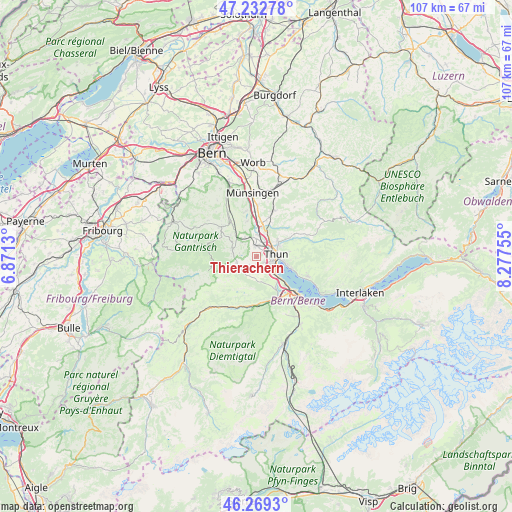
Thierachern GPS coordinates[2]
46° 45' 11.484" North, 7° 34' 27.912" East
| Map corner | latitude | longitude |
|---|---|---|
| Upper-left | 47.23278°, | 6.8713° |
| Center: | 46.75319°, | 7.57442° |
| Lower-right: | 46.2693°, | 8.27755° |
| Map W x H: | 107.1×107.1 km | = 66.5×66.5mi |
| max Lat: | 47.76737° ⇑76.4% North |
| Thierachern: | 46.75319° |
| min Lat: | ⇓23.6% South 45.83203° |
| min Long | Thierachern | max Long |
| 5.97153° | 7.57442° | 10.44624° |
| W 27.4%⇐ | ⇒72.6% E |
Elevation
Elevation of Thierachern is 572 m = 1877 ft, and this is 13.8 m = 45 ft above average elevation for this country.
| Max E: |
1845 m = 6053 ft | 30.2% |
| Thierachern | 572 m 1877 ft | |
| Avg. | 558.2 m = 1831 ft | |
Min E: |
197 m = 646 ft | 69.8% |
See also: Switzerland elevation on elevation.city.
Geographical zone
Thierachern is located in North temperate zone (between Tropic of Cancer and the Arctic Circle). Distance of this North polar circle is 2202.7 km =1368.7 mi to North.| Distance of | km | miles | from Thierachern |
|---|---|---|---|
| North Pole | 4808.6 | 2987.9 | to North |
| Arctic Circle | 2202.7 | 1368.7 | to North |
| Tropic Cancer | 2592.5 | 1610.9 | to South |
| Equator | 5198.5 | 3230.2 | to South |


Nearby cities:
15 places around Thierachern: (largest is in red/bold)
• Amsoldingen
2.9 km =1.8 mi,  167°
167°
• Blumenstein
4.2 km =2.6 mi,  253°
253°
• Burgistein
6.7 km =4.2 mi,  301°
301°
• Fahrni
7.6 km =4.7 mi,  53°
53°
• Heimberg
5.2 km =3.2 mi,  26°
26°
• Hilterfingen
7 km =4.3 mi,  106°
106°
• Kiesen
7.4 km =4.6 mi,  5°
5°
• Reutigen
7.5 km =4.7 mi,  151°
151°
• Seftigen
4.7 km =2.9 mi,  325°
325°
• Steffisburg
5.2 km =3.2 mi,  57°
57°
• Thun
3.6 km =2.2 mi,  93°
93°
• Uebeschi
2.2 km =1.4 mi,  219°
219°
• Uetendorf
2.3 km =1.4 mi,  356°
356°
• Uttigen
4.6 km =2.9 mi,  3°
3°
• Wattenwil
5.4 km =3.4 mi,  290°
290°
Sources, notices
• [Note1] Compared only with cities in Switzerland existing in our database
• [Src1] Map data: © OpenStreetMap contributors (CC-BY-SA)
• [Src2] Other city data from geonames.org with taken over terms of usage.
• [Src3] Geographical zone / Annual Mean Temperature by Robert A. Rohde @ Wikipedia
