Zürich (Kreis 11) / Seebach geodata
Zürich (Kreis 11) / Seebach (Zurich) is a section of populated place; located in Switzerland in Europe/Zurich (GMT+2) time zone. With population of 17,851 people, there are 49 cities with bigger population in this country. Compared to other cities in Switzerland, 78% of cities are located further ↓South; 61.6% of cities are located further ←West and 72.4% of cities have higher elevation than Zürich (Kreis 11) / Seebach. Note1
Current local time in Zürich (Kreis 11) / Seebach:
07:44 AM, SaturdayDifference from your time zone: hours


Zürich (Kreis 11) / Seebach GPS coordinates[2]
47° 25' 18.516" North, 8° 32' 52.044" East
| Map corner | latitude | longitude |
|---|---|---|
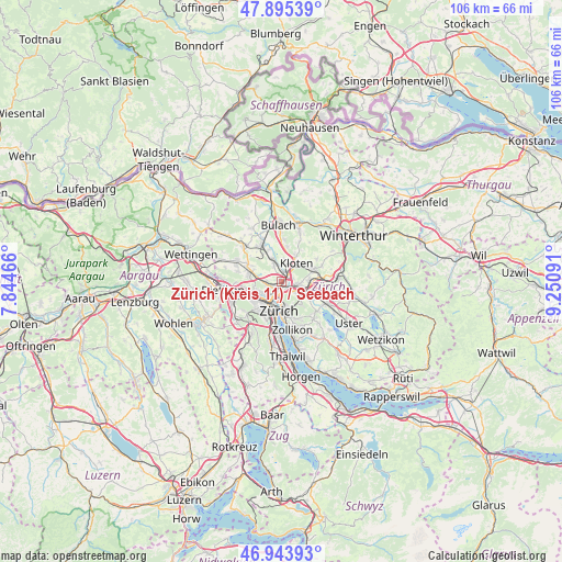
| Upper-left | 47.89539°, | 7.84466° |
| Center: | 47.42181°, | 8.54779° |
| Lower-right: | 46.94393°, | 9.25091° |
| Map W x H: | 105.8×105.8 km | = 65.7×65.7mi |
| max Lat: | 47.76737° ⇑22% North |
| Zürich (Kreis 11) / Seebach: | 47.42181° |
| min Lat: | ⇓78% South 45.83203° |
| min Long | Zürich (Kreis | max Long |
| 5.97153° | 8.54779° | 10.44624° |
| W 61.6%⇐ | ⇒38.4% E |
Elevation
Elevation of Zürich (Kreis 11) / Seebach is 436 m = 1430 ft, and this is 122.2 m = 401 ft below average elevation for this country.
| Max E: |
1845 m = 6053 ft | 72.4% |
| Avg. | 558.2 m = 1831 ft | |
| Zürich (Kreis 11) / Seebach | 436 m = 1430 ft | |
Min E: |
197 m = 646 ft | 27.6% |
See also: Switzerland elevation on elevation.city.
Geographical zone
Zürich (Kreis 11) / Seebach is located in North temperate zone (between Tropic of Cancer and the Arctic Circle). Distance of this North polar circle is 2128.4 km =1322.5 mi to North.| Distance of | km | miles | from Zürich (Kreis 11) / Seebach |
|---|---|---|---|
| North Pole | 4734.3 | 2941.8 | to North |
| Arctic Circle | 2128.4 | 1322.5 | to North |
| Tropic Cancer | 2666.9 | 1657.1 | to South |
| Equator | 5272.8 | 3276.4 | to South |


Nearby cities:
15 places around Zürich (Kreis 11) / Seebach: (largest is in red/bold)
• Glattbrugg
1.5 km =0.9 mi,  46°
46°
• Glattbrugg / Rohr/Platten-Balsberg
2.2 km =1.4 mi,  39°
39°
• Glattbrugg / Wydacker/Bettacker/Lättenwiesen
1.6 km =1 mi,  60°
60°
• Glattbrugg / Zentrum Müllacker
2.1 km =1.3 mi, 49°
• Grossacker/Opfikon
2.4 km =1.5 mi,  76°
76°
• Opfikon
2.4 km =1.5 mi, 62°
• Rietgrabenhang
2.2 km =1.4 mi, 82°
• Wallisellen / Wallisellen-West
2.9 km =1.8 mi,  96°
96°
• Zürich (Kreis 11)
2 km =1.2 mi,  274°
274°
• Zürich (Kreis 11) / Affoltern
2.7 km =1.7 mi,  261°
261°
• Zürich (Kreis 11) / Oerlikon
1.6 km =1 mi,  194°
194°
• Zürich (Kreis 11) / Schwandenholz
2 km =1.2 mi,  279°
279°
• Zürich (Kreis 12) / Auzelg
1.8 km =1.1 mi,  113°
113°
• Zürich (Kreis 12) / Saatlen
1.7 km =1.1 mi,  132°
132°
• Zürich (Kreis 12) / Schwamendingen-Mitte
2.5 km =1.6 mi, 132°
Sources, notices
• [Note1] Compared only with cities in Switzerland existing in our database
• [Src1] Map data: © OpenStreetMap contributors (CC-BY-SA)
• [Src2] Other city data from geonames.org with taken over terms of usage.
• [Src3] Geographical zone / Annual Mean Temperature by Robert A. Rohde @ Wikipedia
