Scuol geodata
Scuol (Grisons) is a populated place; located in Switzerland in Europe/Zurich (GMT+2) time zone. With population of 2,184 people, there are 783 cities with bigger population in this country. Compared to other cities in Switzerland, 74.6% of cities are located further ↑North; 99.8% of cities are located further ←West and 97.4% of cities have lower elevation than Scuol. Note1
Administrative division(s):
- Level 1: Grisons
- Level 2: Region Engiadina Bassa / Val Müstair
- Level 3: Scuol


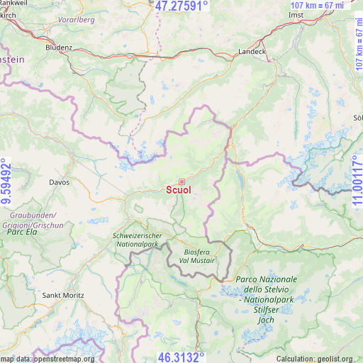
Scuol GPS coordinates[2]
46° 47' 48.156" North, 10° 17' 52.944" East
| Map corner | latitude | longitude |
|---|---|---|
| Upper-left | 47.27591°, | 9.59492° |
| Center: | 46.79671°, | 10.29804° |
| Lower-right: | 46.3132°, | 11.00117° |
| Map W x H: | 107×107 km | = 66.5×66.5mi |
| max Lat: | 47.76737° ⇑74.6% North |
| Scuol: | 46.79671° |
| min Lat: | ⇓25.4% South 45.83203° |
| min Long | Scuol | max Long |
| 5.97153° | 10.29804° | 10.44624° |
| W 99.8%⇐ | ⇒0.2% E |
Elevation
Elevation of Scuol is 1224 m = 4016 ft, and this is 665.8 m = 2184 ft above average elevation for this country.
| Max E: |
1845 m = 6053 ft | 2.6% |
| Scuol | 1224 m 4016 ft | |
| Avg. | 558.2 m = 1831 ft | |
Min E: |
197 m = 646 ft | 97.4% |
See also: Switzerland elevation on elevation.city.
Geographical zone
Scuol is located in North temperate zone (between Tropic of Cancer and the Arctic Circle). Distance of this North polar circle is 2197.9 km =1365.7 mi to North.| Distance of | km | miles | from Scuol |
|---|---|---|---|
| North Pole | 4803.8 | 2984.9 | to North |
| Arctic Circle | 2197.9 | 1365.7 | to North |
| Tropic Cancer | 2597.4 | 1613.9 | to South |
| Equator | 5203.3 | 3233.2 | to South |


Nearby cities:
15 places around Scuol: (largest is in red/bold)
• Davos
35.1 km =21.8 mi,  271°
271°
• Fideris
44.4 km =27.6 mi,  287°
287°
• Klosters Serneus
36.4 km =22.6 mi, 286°
• Küblis
41.6 km =25.8 mi, 288°
• La Punt Chamues-ch
37.6 km =23.4 mi,  229°
229°
• Luzein
43.1 km =26.8 mi, 288°
• Müstair
22 km =13.7 mi,  149°
149°
• Pontresina
45.2 km =28.1 mi,  222°
222°
• Saas im Prättigau
39.3 km =24.4 mi, 288°
• Samedan
43.7 km =27.2 mi, 228°
• Samnaun
17 km =10.6 mi,  16°
16°
• Scanfs
31.5 km =19.6 mi, 229°
• Sent
3.7 km =2.3 mi,  52°
52°
• Zernez
19.1 km =11.9 mi,  235°
235°
• Zuoz
33.7 km =20.9 mi, 230°
Sources, notices
• [Note1] Compared only with cities in Switzerland existing in our database
• [Src1] Map data: © OpenStreetMap contributors (CC-BY-SA)
• [Src2] Other city data from geonames.org with taken over terms of usage.
• [Src3] Geographical zone / Annual Mean Temperature by Robert A. Rohde @ Wikipedia
