La Punt Chamues-ch geodata
La Punt Chamues-ch (Grisons) is a seat of a third-order administrative division; located in Switzerland in Europe/Zurich (GMT+2) time zone. In our database, there are 1823 cities with bigger population. Compared to other cities in Switzerland, 83% of cities are located further ↑North; 99.5% of cities are located further ←West and 99.6% of cities have lower elevation than La Punt Chamues-ch. Note1


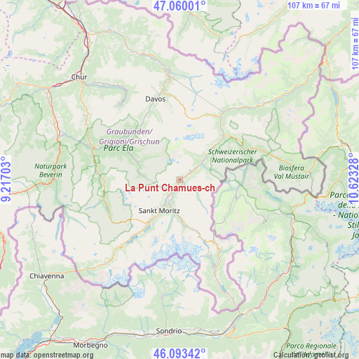
La Punt Chamues-ch GPS coordinates[2]
46° 34' 43.932" North, 9° 55' 12.54" East
| Map corner | latitude | longitude |
|---|---|---|
| Upper-left | 47.06001°, | 9.21703° |
| Center: | 46.57887°, | 9.92015° |
| Lower-right: | 46.09342°, | 10.62328° |
| Map W x H: | 107.5×107.5 km | = 66.8×66.8mi |
| max Lat: | 47.76737° ⇑83% North |
| La Punt Chamues-ch: | 46.57887° |
| min Lat: | ⇓17% South 45.83203° |
| min Long | La Punt Chamues | max Long |
| 5.97153° | 9.92015° | 10.44624° |
| W 99.5%⇐ | ⇒0.5% E |
Elevation
Elevation of La Punt Chamues-ch is 1729 m = 5673 ft, and this is 1170.8 m = 3841 ft above average elevation for this country.
| Max E: |
1845 m = 6053 ft | 0.40000000000001% |
| La Punt Chamues-ch | 1729 m 5673 ft | |
| Avg. | 558.2 m = 1831 ft | |
Min E: |
197 m = 646 ft | 99.6% |
See also: Switzerland elevation on elevation.city.
Geographical zone
La Punt Chamues-ch is located in North temperate zone (between Tropic of Cancer and the Arctic Circle). Distance of this North polar circle is 2222.1 km =1380.7 mi to North.| Distance of | km | miles | from La Punt Chamues-ch |
|---|---|---|---|
| North Pole | 4828 | 3000 | to North |
| Arctic Circle | 2222.1 | 1380.7 | to North |
| Tropic Cancer | 2573.2 | 1598.9 | to South |
| Equator | 5179.1 | 3218.1 | to South |


Nearby cities:
15 places around La Punt Chamues-ch: (largest is in red/bold)
• Arosa
28.9 km =18 mi,  319°
319°
• Bergün
14.3 km =8.9 mi,  293°
293°
• Celerina
8.8 km =5.5 mi,  212°
212°
• Davos
25.8 km =16 mi,  345°
345°
• Filisur
20.7 km =12.9 mi,  300°
300°
• Pontresina
9.4 km =5.8 mi,  188°
188°
• Samedan
6.2 km =3.9 mi,  215°
215°
• Savognin
24.7 km =15.3 mi,  274°
274°
• Scanfs
6.2 km =3.9 mi,  52°
52°
• Sils-Segl Maria
20.5 km =12.7 mi, 215°
• Silvaplana
16.5 km =10.3 mi, 215°
• St. Moritz
10.6 km =6.6 mi, 213°
• Tiefencastel
27.6 km =17.1 mi, 289°
• Zernez
18.7 km =11.6 mi,  44°
44°
• Zuoz
4 km =2.5 mi, 49°
Sources, notices
• [Note1] Compared only with cities in Switzerland existing in our database
• [Src1] Map data: © OpenStreetMap contributors (CC-BY-SA)
• [Src2] Other city data from geonames.org with taken over terms of usage.
• [Src3] Geographical zone / Annual Mean Temperature by Robert A. Rohde @ Wikipedia
