Schwellbrunn geodata
Schwellbrunn (Appenzell Ausserrhoden) is a populated place; located in Switzerland in Europe/Zurich (GMT+2) time zone. With population of 1,517 people, there are 1027 cities with bigger population in this country. Compared to other cities in Switzerland, 65.1% of cities are located further ↓South; 93.5% of cities are located further ←West and 94.1% of cities have lower elevation than Schwellbrunn. Note1
Administrative division(s):
- Level 1: Appenzell Ausserrhoden
- Level 2: Bezirk Hinterland
- Level 3: Schwellbrunn


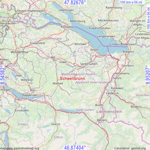
Schwellbrunn GPS coordinates[2]
47° 21' 9.18" North, 9° 14' 56.184" East
| Map corner | latitude | longitude |
|---|---|---|
| Upper-left | 47.82676°, | 8.54582° |
| Center: | 47.35255°, | 9.24894° |
| Lower-right: | 46.87404°, | 9.95207° |
| Map W x H: | 105.9×105.9 km | = 65.8×65.8mi |
| max Lat: | 47.76737° ⇑34.9% North |
| Schwellbrunn: | 47.35255° |
| min Lat: | ⇓65.1% South 45.83203° |
| min Long | Schwellbrunn | max Long |
| 5.97153° | 9.24894° | 10.44624° |
| W 93.5%⇐ | ⇒6.5% E |
Elevation
Elevation of Schwellbrunn is 962 m = 3156 ft, and this is 403.8 m = 1325 ft above average elevation for this country.
| Max E: |
1845 m = 6053 ft | 5.9% |
| Schwellbrunn | 962 m 3156 ft | |
| Avg. | 558.2 m = 1831 ft | |
Min E: |
197 m = 646 ft | 94.1% |
See also: Switzerland elevation on elevation.city.
Geographical zone
Schwellbrunn is located in North temperate zone (between Tropic of Cancer and the Arctic Circle). Distance of this North polar circle is 2136.1 km =1327.3 mi to North.| Distance of | km | miles | from Schwellbrunn |
|---|---|---|---|
| North Pole | 4742 | 2946.5 | to North |
| Arctic Circle | 2136.1 | 1327.3 | to North |
| Tropic Cancer | 2659.2 | 1652.3 | to South |
| Equator | 5265.1 | 3271.6 | to South |


Nearby cities:
15 places around Schwellbrunn: (largest is in red/bold)
• Abtwil
9.6 km =6 mi,  34°
34°
• Andwil
9.8 km =6.1 mi,  11°
11°
• Brunnadern
9.1 km =5.7 mi,  258°
258°
• Degersheim
4.4 km =2.7 mi,  303°
303°
• Flawil
8.3 km =5.2 mi,  323°
323°
• Gonten
7.9 km =4.9 mi,  110°
110°
• Gossau
7 km =4.3 mi,  3°
3°
• Haslen
9.1 km =5.7 mi,  78°
78°
• Hemberg
8 km =5 mi,  223°
223°
• Herisau
4.4 km =2.7 mi, 31°
• Hundwil
5.4 km =3.4 mi, 75°
• Mogelsberg
8.6 km =5.3 mi,  277°
277°
• Sankt Peterzell
6.7 km =4.2 mi,  234°
234°
• Urnäsch
4.6 km =2.9 mi,  149°
149°
• Waldstatt
2.6 km =1.6 mi, 80°
Sources, notices
• [Note1] Compared only with cities in Switzerland existing in our database
• [Src1] Map data: © OpenStreetMap contributors (CC-BY-SA)
• [Src2] Other city data from geonames.org with taken over terms of usage.
• [Src3] Geographical zone / Annual Mean Temperature by Robert A. Rohde @ Wikipedia
