Gonten geodata
Gonten (Appenzell Innerrhoden) is a populated place; located in Switzerland in Europe/Zurich (GMT+2) time zone. With population of 1,406 people, there are 1080 cities with bigger population in this country. Compared to other cities in Switzerland, 61.9% of cities are located further ↓South; 94.6% of cities are located further ←West and 92.4% of cities have lower elevation than Gonten. Note1
Administrative division(s):
- Level 1: Appenzell Innerrhoden
- Level 2: Appenzell Inner Rhodes
- Level 3: Gonten


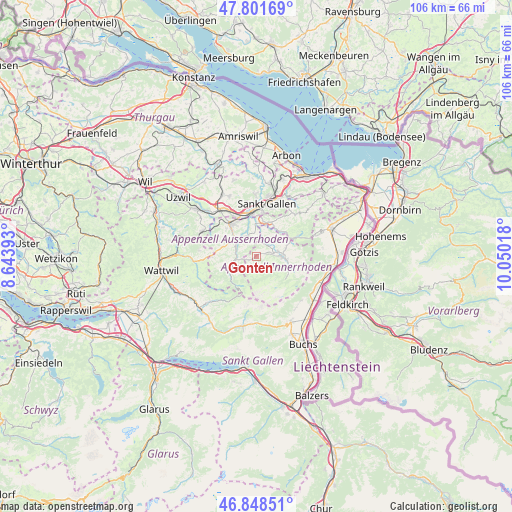
Gonten GPS coordinates[2]
47° 19' 38.1" North, 9° 20' 49.38" East
| Map corner | latitude | longitude |
|---|---|---|
| Upper-left | 47.80169°, | 8.64393° |
| Center: | 47.32725°, | 9.34705° |
| Lower-right: | 46.84851°, | 10.05018° |
| Map W x H: | 106×106 km | = 65.9×65.9mi |
| max Lat: | 47.76737° ⇑38.1% North |
| Gonten: | 47.32725° |
| min Lat: | ⇓61.9% South 45.83203° |
| min Long | Gonten | max Long |
| 5.97153° | 9.34705° | 10.44624° |
| W 94.6%⇐ | ⇒5.4% E |
Elevation
Elevation of Gonten is 900 m = 2953 ft, and this is 341.8 m = 1121 ft above average elevation for this country.
| Max E: |
1845 m = 6053 ft | 7.6% |
| Gonten | 900 m 2953 ft | |
| Avg. | 558.2 m = 1831 ft | |
Min E: |
197 m = 646 ft | 92.4% |
See also: Switzerland elevation on elevation.city.
Geographical zone
Gonten is located in North temperate zone (between Tropic of Cancer and the Arctic Circle). Distance of this North polar circle is 2138.9 km =1329.1 mi to North.| Distance of | km | miles | from Gonten |
|---|---|---|---|
| North Pole | 4744.8 | 2948.3 | to North |
| Arctic Circle | 2138.9 | 1329.1 | to North |
| Tropic Cancer | 2656.4 | 1650.6 | to South |
| Equator | 5262.3 | 3269.8 | to South |


Nearby cities:
15 places around Gonten: (largest is in red/bold)
• Abtwil
10.9 km =6.8 mi,  349°
349°
• Appenzell
4.8 km =3 mi,  84°
84°
• Bühler
7.8 km =4.8 mi,  48°
48°
• Degersheim
12.2 km =7.6 mi,  295°
295°
• Gais
8.9 km =5.5 mi,  64°
64°
• Gossau
12 km =7.5 mi,  324°
324°
• Haslen
4.9 km =3 mi,  18°
18°
• Herisau
8.3 km =5.2 mi, 322°
• Hundwil
4.7 km =2.9 mi,  332°
332°
• Sankt Gallen
10.9 km =6.8 mi,  10°
10°
• Schwellbrunn
7.9 km =4.9 mi,  290°
290°
• Speicher
11.8 km =7.3 mi,  37°
37°
• Teufen
7.7 km =4.8 mi, 22°
• Urnäsch
5.2 km =3.2 mi,  257°
257°
• Waldstatt
5.8 km =3.6 mi, 303°
Sources, notices
• [Note1] Compared only with cities in Switzerland existing in our database
• [Src1] Map data: © OpenStreetMap contributors (CC-BY-SA)
• [Src2] Other city data from geonames.org with taken over terms of usage.
• [Src3] Geographical zone / Annual Mean Temperature by Robert A. Rohde @ Wikipedia
