Andwil geodata
Andwil (Saint Gallen) is a populated place; located in Switzerland in Europe/Zurich (GMT+2) time zone. With population of 1,737 people, there are 928 cities with bigger population in this country. Compared to other cities in Switzerland, 80.7% of cities are located further ↓South; 93.7% of cities are located further ←West and 83.4% of cities have lower elevation than Andwil. Note1
Administrative division(s):
- Level 1: Saint Gallen
- Level 2: Wahlkreis St. Gallen
- Level 3: Andwil (SG)


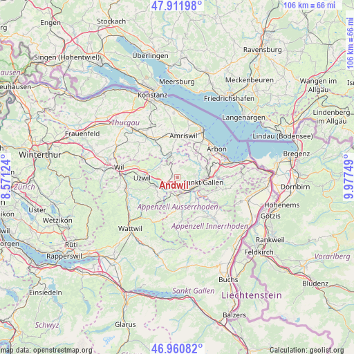
Andwil GPS coordinates[2]
47° 26' 18.78" North, 9° 16' 27.696" East
| Map corner | latitude | longitude |
|---|---|---|
| Upper-left | 47.91198°, | 8.57124° |
| Center: | 47.43855°, | 9.27436° |
| Lower-right: | 46.96082°, | 9.97749° |
| Map W x H: | 105.8×105.8 km | = 65.7×65.7mi |
| max Lat: | 47.76737° ⇑19.3% North |
| Andwil: | 47.43855° |
| min Lat: | ⇓80.7% South 45.83203° |
| min Long | Andwil | max Long |
| 5.97153° | 9.27436° | 10.44624° |
| W 93.7%⇐ | ⇒6.3% E |
Elevation
Elevation of Andwil is 711 m = 2333 ft, and this is 152.8 m = 501 ft above average elevation for this country.
| Max E: |
1845 m = 6053 ft | 16.6% |
| Andwil | 711 m 2333 ft | |
| Avg. | 558.2 m = 1831 ft | |
Min E: |
197 m = 646 ft | 83.4% |
See also: Switzerland elevation on elevation.city.
Geographical zone
Andwil is located in North temperate zone (between Tropic of Cancer and the Arctic Circle). Distance of this North polar circle is 2126.5 km =1321.3 mi to North.| Distance of | km | miles | from Andwil |
|---|---|---|---|
| North Pole | 4732.4 | 2940.6 | to North |
| Arctic Circle | 2126.5 | 1321.3 | to North |
| Tropic Cancer | 2668.8 | 1658.3 | to South |
| Equator | 5274.7 | 3277.5 | to South |


Nearby cities:
15 places around Andwil: (largest is in red/bold)
• Abtwil
3.9 km =2.4 mi,  115°
115°
• Degersheim
9.1 km =5.7 mi,  217°
217°
• Flawil
7.4 km =4.6 mi,  247°
247°
• Gossau
3 km =1.9 mi,  209°
209°
• Herisau
5.8 km =3.6 mi,  176°
176°
• Hohentannen
8.6 km =5.3 mi,  334°
334°
• Hundwil
8.9 km =5.5 mi,  158°
158°
• Häggenschwil
8.2 km =5.1 mi,  40°
40°
• Niederbüren
6 km =3.7 mi,  300°
300°
• Niederhelfenschwil
7.8 km =4.8 mi, 301°
• Sankt Gallen
7.7 km =4.8 mi,  102°
102°
• Schwellbrunn
9.8 km =6.1 mi,  191°
191°
• Waldkirch
3.5 km =2.2 mi,  15°
15°
• Waldstatt
9.2 km =5.7 mi, 175°
• Wittenbach
8.8 km =5.5 mi,  73°
73°
Sources, notices
• [Note1] Compared only with cities in Switzerland existing in our database
• [Src1] Map data: © OpenStreetMap contributors (CC-BY-SA)
• [Src2] Other city data from geonames.org with taken over terms of usage.
• [Src3] Geographical zone / Annual Mean Temperature by Robert A. Rohde @ Wikipedia
