Hundwil geodata
Hundwil (Appenzell Ausserrhoden) is a populated place; located in Switzerland in Europe/Zurich (GMT+2) time zone. With population of 975 people, there are 1345 cities with bigger population in this country. Compared to other cities in Switzerland, 66.8% of cities are located further ↓South; 94.3% of cities are located further ←West and 88.7% of cities have lower elevation than Hundwil. Note1
Administrative division(s):
- Level 1: Appenzell Ausserrhoden
- Level 2: Bezirk Hinterland
- Level 3: Hundwil


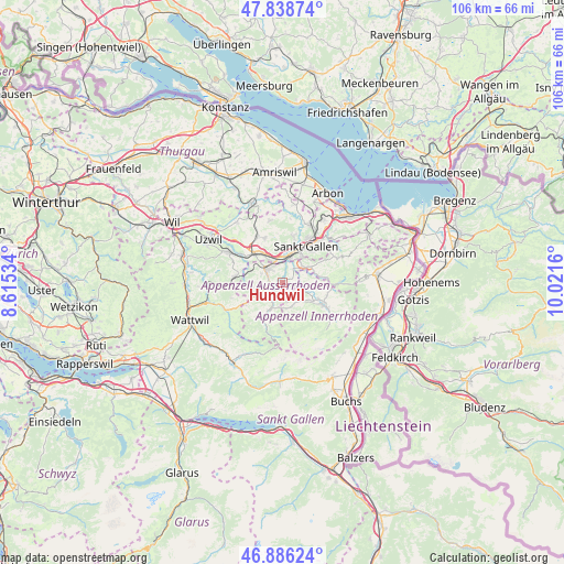
Hundwil GPS coordinates[2]
47° 21' 52.704" North, 9° 19' 6.492" East
| Map corner | latitude | longitude |
|---|---|---|
| Upper-left | 47.83874°, | 8.61534° |
| Center: | 47.36464°, | 9.31847° |
| Lower-right: | 46.88624°, | 10.0216° |
| Map W x H: | 105.9×105.9 km | = 65.8×65.8mi |
| max Lat: | 47.76737° ⇑33.2% North |
| Hundwil: | 47.36464° |
| min Lat: | ⇓66.8% South 45.83203° |
| min Long | Hundwil | max Long |
| 5.97153° | 9.31847° | 10.44624° |
| W 94.3%⇐ | ⇒5.7% E |
Elevation
Elevation of Hundwil is 792 m = 2598 ft, and this is 233.8 m = 767 ft above average elevation for this country.
| Max E: |
1845 m = 6053 ft | 11.3% |
| Hundwil | 792 m 2598 ft | |
| Avg. | 558.2 m = 1831 ft | |
Min E: |
197 m = 646 ft | 88.7% |
See also: Switzerland elevation on elevation.city.
Geographical zone
Hundwil is located in North temperate zone (between Tropic of Cancer and the Arctic Circle). Distance of this North polar circle is 2134.7 km =1326.4 mi to North.| Distance of | km | miles | from Hundwil |
|---|---|---|---|
| North Pole | 4740.6 | 2945.7 | to North |
| Arctic Circle | 2134.7 | 1326.4 | to North |
| Tropic Cancer | 2660.5 | 1653.2 | to South |
| Equator | 5266.5 | 3272.5 | to South |


Nearby cities:
15 places around Hundwil: (largest is in red/bold)
• Abtwil
6.6 km =4.1 mi,  1°
1°
• Andwil
8.9 km =5.5 mi,  338°
338°
• Appenzell
7.8 km =4.8 mi,  118°
118°
• Bühler
8.1 km =5 mi,  83°
83°
• Degersheim
9 km =5.6 mi,  276°
276°
• Gais
10.2 km =6.3 mi,  91°
91°
• Gonten
4.7 km =2.9 mi,  152°
152°
• Gossau
7.4 km =4.6 mi,  319°
319°
• Haslen
3.7 km =2.3 mi, 81°
• Herisau
3.8 km =2.4 mi,  308°
308°
• Sankt Gallen
7.8 km =4.8 mi,  32°
32°
• Schwellbrunn
5.4 km =3.4 mi,  255°
255°
• Teufen
5.9 km =3.7 mi,  60°
60°
• Urnäsch
6.1 km =3.8 mi,  208°
208°
• Waldstatt
2.8 km =1.7 mi,  250°
250°
Sources, notices
• [Note1] Compared only with cities in Switzerland existing in our database
• [Src1] Map data: © OpenStreetMap contributors (CC-BY-SA)
• [Src2] Other city data from geonames.org with taken over terms of usage.
• [Src3] Geographical zone / Annual Mean Temperature by Robert A. Rohde @ Wikipedia
