Renens geodata
Renens (Vaud) is a seat of a second-order administrative division; located in Switzerland in Europe/Zurich (GMT+2) time zone. With population of 17,811 people, there are 50 cities with bigger population in this country. Compared to other cities in Switzerland, 84% of cities are located further ↑North; 94.3% of cities are located further →East and 67.9% of cities have higher elevation than Renens. Note1


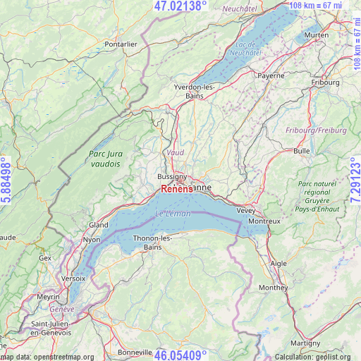
Renens GPS coordinates[2]
46° 32' 23.604" North, 6° 35' 17.16" East
| Map corner | latitude | longitude |
|---|---|---|
| Upper-left | 47.02138°, | 5.88498° |
| Center: | 46.53989°, | 6.5881° |
| Lower-right: | 46.05409°, | 7.29123° |
| Map W x H: | 107.6×107.6 km | = 66.9×66.9mi |
| max Lat: | 47.76737° ⇑84% North |
| Renens: | 46.53989° |
| min Lat: | ⇓16% South 45.83203° |
| min Long | Renens | max Long |
| 5.97153° | 6.5881° | 10.44624° |
| W 5.7%⇐ | ⇒94.3% E |
Elevation
Elevation of Renens is 441 m = 1447 ft, and this is 117.2 m = 385 ft below average elevation for this country.
| Max E: |
1845 m = 6053 ft | 67.9% |
| Avg. | 558.2 m = 1831 ft | |
| Renens | 441 m = 1447 ft | |
Min E: |
197 m = 646 ft | 32.1% |
See also: Switzerland elevation on elevation.city.
Geographical zone
Renens is located in North temperate zone (between Tropic of Cancer and the Arctic Circle). Distance of this North polar circle is 2226.4 km =1383.4 mi to North.| Distance of | km | miles | from Renens |
|---|---|---|---|
| North Pole | 4832.3 | 3002.7 | to North |
| Arctic Circle | 2226.4 | 1383.4 | to North |
| Tropic Cancer | 2568.8 | 1596.2 | to South |
| Equator | 5174.8 | 3215.5 | to South |


Nearby cities:
15 places around Renens: (largest is in red/bold)
• Belmont-sur-Lausanne
7.1 km =4.4 mi,  109°
109°
• Blécherette
2.6 km =1.6 mi,  91°
91°
• Bussigny
2.8 km =1.7 mi,  296°
296°
• Chavannes
1.7 km =1.1 mi,  230°
230°
• Cheseaux
5.3 km =3.3 mi,  14°
14°
• Crissier
1.2 km =0.7 mi, 304°
• Ecublens
2.3 km =1.4 mi,  238°
238°
• Epalinges
6.2 km =3.9 mi,  80°
80°
• Lausanne
4.3 km =2.7 mi,  127°
127°
• Le Mont-sur-Lausanne
3.9 km =2.4 mi,  58°
58°
• Paudex
7.2 km =4.5 mi,  121°
121°
• Prilly
1.3 km =0.8 mi,  104°
104°
• Préverenges
5.3 km =3.3 mi, 243°
• Pully
6.5 km =4 mi, 120°
• Romanel-sur-Lausanne
3 km =1.9 mi,  26°
26°
Sources, notices
• [Note1] Compared only with cities in Switzerland existing in our database
• [Src1] Map data: © OpenStreetMap contributors (CC-BY-SA)
• [Src2] Other city data from geonames.org with taken over terms of usage.
• [Src3] Geographical zone / Annual Mean Temperature by Robert A. Rohde @ Wikipedia
