Belmont-sur-Lausanne geodata
Belmont-sur-Lausanne (Vaud) is a populated place; located in Switzerland in Europe/Zurich (GMT+2) time zone. With population of 3,007 people, there are 590 cities with bigger population in this country. Compared to other cities in Switzerland, 84.8% of cities are located further ↑North; 92.8% of cities are located further →East and 72.5% of cities have lower elevation than Belmont-sur-Lausanne. Note1
Administrative division(s):
- Level 1: Vaud
- Level 2: Lavaux-Oron District
- Level 3: Belmont-sur-Lausanne


Belmont-sur-Lausanne GPS coordinates[2]
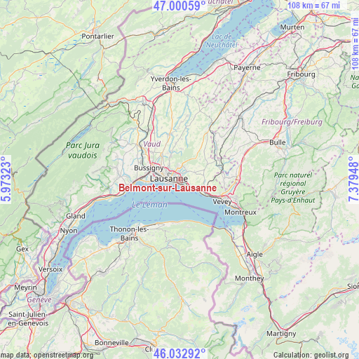
46° 31' 8.076" North, 6° 40' 34.896" East
| Map corner | latitude | longitude |
|---|---|---|
| Upper-left | 47.00059°, | 5.97323° |
| Center: | 46.51891°, | 6.67636° |
| Lower-right: | 46.03292°, | 7.37948° |
| Map W x H: | 107.6×107.6 km | = 66.9×66.9mi |
| max Lat: | 47.76737° ⇑84.8% North |
| Belmont-sur-Lausanne: | 46.51891° |
| min Lat: | ⇓15.2% South 45.83203° |
| min Long | Belmont-sur-Lau | max Long |
| 5.97153° | 6.67636° | 10.44624° |
| W 7.2%⇐ | ⇒92.8% E |
Elevation
Elevation of Belmont-sur-Lausanne is 593 m = 1946 ft, and this is 34.8 m = 114 ft above average elevation for this country.
| Max E: |
1845 m = 6053 ft | 27.5% |
| Belmont-sur-Lausanne | 593 m 1946 ft | |
| Avg. | 558.2 m = 1831 ft | |
Min E: |
197 m = 646 ft | 72.5% |
See also: Switzerland elevation on elevation.city.
Geographical zone
Belmont-sur-Lausanne is located in North temperate zone (between Tropic of Cancer and the Arctic Circle). Distance of this North polar circle is 2228.8 km =1384.9 mi to North.| Distance of | km | miles | from Belmont-sur-Lausanne |
|---|---|---|---|
| North Pole | 4834.6 | 3004.1 | to North |
| Arctic Circle | 2228.8 | 1384.9 | to North |
| Tropic Cancer | 2566.5 | 1594.7 | to South |
| Equator | 5172.4 | 3214 | to South |


Nearby cities:
15 places around Belmont-sur-Lausanne: (largest is in red/bold)
• Blécherette
4.7 km =2.9 mi,  298°
298°
• Chavannes
8.2 km =5.1 mi,  278°
278°
• Crissier
8.3 km =5.2 mi,  291°
291°
• Cully
5.3 km =3.3 mi,  129°
129°
• Epalinges
3.4 km =2.1 mi,  349°
349°
• Lausanne
3.3 km =2.1 mi,  264°
264°
• Le Mont-sur-Lausanne
5.6 km =3.5 mi,  321°
321°
• Lutry
2 km =1.2 mi,  157°
157°
• Paudex
1.6 km =1 mi,  202°
202°
• Prilly
5.8 km =3.6 mi, 290°
• Puidoux
8.4 km =5.2 mi,  103°
103°
• Pully
1.5 km =0.9 mi,  229°
229°
• Renens
7.1 km =4.4 mi, 289°
• Romanel-sur-Lausanne
7.4 km =4.6 mi,  312°
312°
• Savigny
4.8 km =3 mi,  63°
63°
Sources, notices
• [Note1] Compared only with cities in Switzerland existing in our database
• [Src1] Map data: © OpenStreetMap contributors (CC-BY-SA)
• [Src2] Other city data from geonames.org with taken over terms of usage.
• [Src3] Geographical zone / Annual Mean Temperature by Robert A. Rohde @ Wikipedia
