Raron geodata
Raron (Valais) is a seat of a second-order administrative division; located in Switzerland in Europe/Zurich (GMT+2) time zone. With population of 1,901 people, there are 872 cities with bigger population in this country. Compared to other cities in Switzerland, 90.2% of cities are located further ↑North; 65.4% of cities are located further →East and 78.3% of cities have lower elevation than Raron. Note1


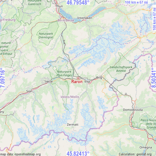
Raron GPS coordinates[2]
46° 18' 43.056" North, 7° 48' 1.044" East
| Map corner | latitude | longitude |
|---|---|---|
| Upper-left | 46.79548°, | 7.09716° |
| Center: | 46.31196°, | 7.80029° |
| Lower-right: | 45.82413°, | 8.50341° |
| Map W x H: | 108×108 km | = 67.1×67.1mi |
| max Lat: | 47.76737° ⇑90.2% North |
| Raron: | 46.31196° |
| min Lat: | ⇓9.8% South 45.83203° |
| min Long | Raron | max Long |
| 5.97153° | 7.80029° | 10.44624° |
| W 34.6%⇐ | ⇒65.4% E |
Elevation
Elevation of Raron is 644 m = 2113 ft, and this is 85.8 m = 281 ft above average elevation for this country.
| Max E: |
1845 m = 6053 ft | 21.7% |
| Raron | 644 m 2113 ft | |
| Avg. | 558.2 m = 1831 ft | |
Min E: |
197 m = 646 ft | 78.3% |
See also: Switzerland elevation on elevation.city.
Geographical zone
Raron is located in North temperate zone (between Tropic of Cancer and the Arctic Circle). Distance of this North polar circle is 2251.8 km =1399.2 mi to North.| Distance of | km | miles | from Raron |
|---|---|---|---|
| North Pole | 4857.7 | 3018.4 | to North |
| Arctic Circle | 2251.8 | 1399.2 | to North |
| Tropic Cancer | 2543.5 | 1580.5 | to South |
| Equator | 5149.4 | 3199.7 | to South |


Nearby cities:
15 places around Raron: (largest is in red/bold)
• Agarn
10.7 km =6.6 mi,  261°
261°
• Baltschieder
5 km =3.1 mi,  93°
93°
• Bürchen
3.7 km =2.3 mi,  162°
162°
• Eischoll
2.6 km =1.6 mi,  217°
217°
• Gampel
4.5 km =2.8 mi,  275°
275°
• Lalden
8 km =5 mi,  100°
100°
• Mund
10.8 km =6.7 mi, 88°
• Niedergesteln
1.3 km =0.8 mi,  272°
272°
• Stalden
10.4 km =6.5 mi,  147°
147°
• Staldenried
11.2 km =7 mi, 145°
• Turtmann
7.7 km =4.8 mi, 260°
• Törbel
9.1 km =5.7 mi, 153°
• Visp
6.6 km =4.1 mi,  108°
108°
• Visperterminen
9.8 km =6.1 mi,  127°
127°
• Wiler
10.2 km =6.3 mi,  351°
351°
Sources, notices
• [Note1] Compared only with cities in Switzerland existing in our database
• [Src1] Map data: © OpenStreetMap contributors (CC-BY-SA)
• [Src2] Other city data from geonames.org with taken over terms of usage.
• [Src3] Geographical zone / Annual Mean Temperature by Robert A. Rohde @ Wikipedia
