Baltschieder geodata
Baltschieder (Valais) is a populated place; located in Switzerland in Europe/Zurich (GMT+2) time zone. With population of 1,158 people, there are 1225 cities with bigger population in this country. Compared to other cities in Switzerland, 90.5% of cities are located further ↑North; 63.5% of cities are located further →East and 80.1% of cities have lower elevation than Baltschieder. Note1


Baltschieder GPS coordinates[2]
46° 18' 31.968" North, 7° 51' 56.52" East
| Map corner | latitude | longitude |
|---|---|---|
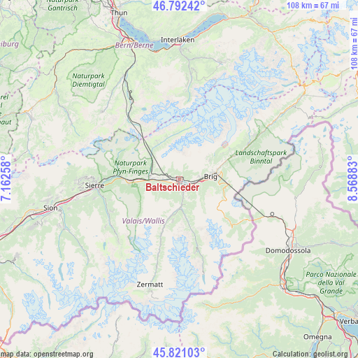
| Upper-left | 46.79242°, | 7.16258° |
| Center: | 46.30888°, | 7.8657° |
| Lower-right: | 45.82103°, | 8.56883° |
| Map W x H: | 108×108 km | = 67.1×67.1mi |
| max Lat: | 47.76737° ⇑90.5% North |
| Baltschieder: | 46.30888° |
| min Lat: | ⇓9.5% South 45.83203° |
| min Long | Baltschieder | max Long |
| 5.97153° | 7.8657° | 10.44624° |
| W 36.5%⇐ | ⇒63.5% E |
Elevation
Elevation of Baltschieder is 661 m = 2169 ft, and this is 102.8 m = 337 ft above average elevation for this country.
| Max E: |
1845 m = 6053 ft | 19.9% |
| Baltschieder | 661 m 2169 ft | |
| Avg. | 558.2 m = 1831 ft | |
Min E: |
197 m = 646 ft | 80.1% |
See also: Switzerland elevation on elevation.city.
Geographical zone
Baltschieder is located in North temperate zone (between Tropic of Cancer and the Arctic Circle). Distance of this North polar circle is 2252.1 km =1399.4 mi to North.| Distance of | km | miles | from Baltschieder |
|---|---|---|---|
| North Pole | 4858 | 3018.6 | to North |
| Arctic Circle | 2252.1 | 1399.4 | to North |
| Tropic Cancer | 2543.1 | 1580.2 | to South |
| Equator | 5149.1 | 3199.5 | to South |


Nearby cities:
15 places around Baltschieder: (largest is in red/bold)
• Bitsch
11.6 km =7.2 mi,  73°
73°
• Brig
9.1 km =5.7 mi,  84°
84°
• Bürchen
5 km =3.1 mi,  230°
230°
• Eischoll
6.8 km =4.2 mi,  255°
255°
• Gampel
9.5 km =5.9 mi,  274°
274°
• Lalden
3 km =1.9 mi,  110°
110°
• Mund
5.8 km =3.6 mi, 83°
• Naters
9.7 km =6 mi, 79°
• Niedergesteln
6.3 km =3.9 mi, 273°
• Raron
5 km =3.1 mi, 273°
• Stalden
8.4 km =5.2 mi,  176°
176°
• Staldenried
8.9 km =5.5 mi,  171°
171°
• Törbel
7.9 km =4.9 mi,  187°
187°
• Visp
2.1 km =1.3 mi,  144°
144°
• Visperterminen
6.2 km =3.9 mi,  153°
153°
Sources, notices
• [Note1] Compared only with cities in Switzerland existing in our database
• [Src1] Map data: © OpenStreetMap contributors (CC-BY-SA)
• [Src2] Other city data from geonames.org with taken over terms of usage.
• [Src3] Geographical zone / Annual Mean Temperature by Robert A. Rohde @ Wikipedia
