Niedergesteln geodata
Niedergesteln (Valais) is a populated place; located in Switzerland in Europe/Zurich (GMT+2) time zone. With population of 615 people, there are 1681 cities with bigger population in this country. Compared to other cities in Switzerland, 90.1% of cities are located further ↑North; 66.1% of cities are located further →East and 77.1% of cities have lower elevation than Niedergesteln. Note1


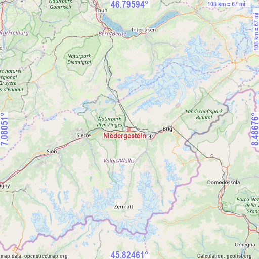
Niedergesteln GPS coordinates[2]
46° 18' 44.748" North, 7° 47' 1.104" East
| Map corner | latitude | longitude |
|---|---|---|
| Upper-left | 46.79594°, | 7.08051° |
| Center: | 46.31243°, | 7.78364° |
| Lower-right: | 45.82461°, | 8.48676° |
| Map W x H: | 108×108 km | = 67.1×67.1mi |
| max Lat: | 47.76737° ⇑90.1% North |
| Niedergesteln: | 46.31243° |
| min Lat: | ⇓9.9% South 45.83203° |
| min Long | Niedergesteln | max Long |
| 5.97153° | 7.78364° | 10.44624° |
| W 33.9%⇐ | ⇒66.1% E |
Elevation
Elevation of Niedergesteln is 635 m = 2083 ft, and this is 76.8 m = 252 ft above average elevation for this country.
| Max E: |
1845 m = 6053 ft | 22.9% |
| Niedergesteln | 635 m 2083 ft | |
| Avg. | 558.2 m = 1831 ft | |
Min E: |
197 m = 646 ft | 77.1% |
See also: Switzerland elevation on elevation.city.
Geographical zone
Niedergesteln is located in North temperate zone (between Tropic of Cancer and the Arctic Circle). Distance of this North polar circle is 2251.7 km =1399.1 mi to North.| Distance of | km | miles | from Niedergesteln |
|---|---|---|---|
| North Pole | 4857.6 | 3018.4 | to North |
| Arctic Circle | 2251.7 | 1399.1 | to North |
| Tropic Cancer | 2543.5 | 1580.5 | to South |
| Equator | 5149.5 | 3199.7 | to South |


Nearby cities:
15 places around Niedergesteln: (largest is in red/bold)
• Agarn
9.4 km =5.8 mi,  259°
259°
• Baltschieder
6.3 km =3.9 mi,  93°
93°
• Bürchen
4.3 km =2.7 mi,  145°
145°
• Eischoll
2.1 km =1.3 mi,  187°
187°
• Gampel
3.2 km =2 mi,  277°
277°
• Lalden
9.2 km =5.7 mi,  98°
98°
• Leuk
11.5 km =7.1 mi,  272°
272°
• Raron
1.3 km =0.8 mi, 92°
• Stalden
11.1 km =6.9 mi,  142°
142°
• Staldenried
12 km =7.5 mi, 140°
• Turtmann
6.4 km =4 mi, 257°
• Törbel
9.8 km =6.1 mi, 147°
• Visp
7.8 km =4.8 mi,  105°
105°
• Visperterminen
10.9 km =6.8 mi,  123°
123°
• Wiler
10.1 km =6.3 mi,  359°
359°
Sources, notices
• [Note1] Compared only with cities in Switzerland existing in our database
• [Src1] Map data: © OpenStreetMap contributors (CC-BY-SA)
• [Src2] Other city data from geonames.org with taken over terms of usage.
• [Src3] Geographical zone / Annual Mean Temperature by Robert A. Rohde @ Wikipedia
