Payerne geodata
Payerne (Vaud) is a seat of a second-order administrative division; located in Switzerland in Europe/Zurich (GMT+2) time zone. With population of 7,655 people, there are 212 cities with bigger population in this country. Compared to other cities in Switzerland, 73.2% of cities are located further ↑North; 88.7% of cities are located further →East and 59.8% of cities have higher elevation than Payerne. Note1


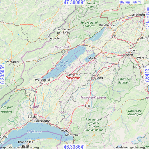
Payerne GPS coordinates[2]
46° 49' 18.912" North, 6° 56' 17.412" East
| Map corner | latitude | longitude |
|---|---|---|
| Upper-left | 47.30089°, | 6.23505° |
| Center: | 46.82192°, | 6.93817° |
| Lower-right: | 46.33864°, | 7.6413° |
| Map W x H: | 107×107 km | = 66.5×66.5mi |
| max Lat: | 47.76737° ⇑73.2% North |
| Payerne: | 46.82192° |
| min Lat: | ⇓26.8% South 45.83203° |
| min Long | Payerne | max Long |
| 5.97153° | 6.93817° | 10.44624° |
| W 11.3%⇐ | ⇒88.7% E |
Elevation
Elevation of Payerne is 455 m = 1493 ft, and this is 103.2 m = 339 ft below average elevation for this country.
| Max E: |
1845 m = 6053 ft | 59.8% |
| Avg. | 558.2 m = 1831 ft | |
| Payerne | 455 m = 1493 ft | |
Min E: |
197 m = 646 ft | 40.2% |
See also: Switzerland elevation on elevation.city.
Geographical zone
Payerne is located in North temperate zone (between Tropic of Cancer and the Arctic Circle). Distance of this North polar circle is 2195.1 km =1364 mi to North.| Distance of | km | miles | from Payerne |
|---|---|---|---|
| North Pole | 4801 | 2983.2 | to North |
| Arctic Circle | 2195.1 | 1364 | to North |
| Tropic Cancer | 2600.2 | 1615.7 | to South |
| Equator | 5206.1 | 3234.9 | to South |


Nearby cities:
15 places around Payerne: (largest is in red/bold)
• Avenches
10.1 km =6.3 mi,  50°
50°
• Avry-sur-Matran
10.5 km =6.5 mi,  111°
111°
• Cugy
3.8 km =2.4 mi,  258°
258°
• Domdidier
7.6 km =4.7 mi, 48°
• Dompierre
5.2 km =3.2 mi, 50°
• Estavayer-le-Lac
7.6 km =4.7 mi,  293°
293°
• Gletterens
8.1 km =5 mi,  359°
359°
• Grandcour
5.6 km =3.5 mi,  352°
352°
• Granges
7.6 km =4.7 mi,  209°
209°
• Grolley
10.2 km =6.3 mi,  82°
82°
• Lully
7.2 km =4.5 mi,  280°
280°
• Léchelles
6 km =3.7 mi, 82°
• Noréaz
7.2 km =4.5 mi, 108°
• Ponthaux
7.9 km =4.9 mi,  95°
95°
• Surpierre
10.3 km =6.4 mi,  215°
215°
Sources, notices
• [Note1] Compared only with cities in Switzerland existing in our database
• [Src1] Map data: © OpenStreetMap contributors (CC-BY-SA)
• [Src2] Other city data from geonames.org with taken over terms of usage.
• [Src3] Geographical zone / Annual Mean Temperature by Robert A. Rohde @ Wikipedia
