Granges geodata
Granges (Vaud) is a populated place; located in Switzerland in Europe/Zurich (GMT+2) time zone. With population of 617 people, there are 1675 cities with bigger population in this country. Compared to other cities in Switzerland, 76.2% of cities are located further ↑North; 89.9% of cities are located further →East and 54.8% of cities have higher elevation than Granges. Note1


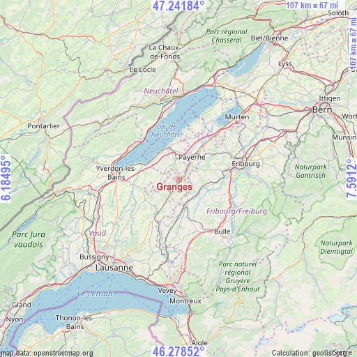
Granges GPS coordinates[2]
46° 45' 44.388" North, 6° 53' 17.088" East
| Map corner | latitude | longitude |
|---|---|---|
| Upper-left | 47.24184°, | 6.18495° |
| Center: | 46.76233°, | 6.88808° |
| Lower-right: | 46.27852°, | 7.5912° |
| Map W x H: | 107.1×107.1 km | = 66.5×66.5mi |
| max Lat: | 47.76737° ⇑76.2% North |
| Granges: | 46.76233° |
| min Lat: | ⇓23.8% South 45.83203° |
| min Long | Granges | max Long |
| 5.97153° | 6.88808° | 10.44624° |
| W 10.1%⇐ | ⇒89.9% E |
Elevation
Elevation of Granges is 468 m = 1535 ft, and this is 90.2 m = 296 ft below average elevation for this country.
| Max E: |
1845 m = 6053 ft | 54.8% |
| Avg. | 558.2 m = 1831 ft | |
| Granges | 468 m = 1535 ft | |
Min E: |
197 m = 646 ft | 45.2% |
See also: Switzerland elevation on elevation.city.
Geographical zone
Granges is located in North temperate zone (between Tropic of Cancer and the Arctic Circle). Distance of this North polar circle is 2201.7 km =1368.1 mi to North.| Distance of | km | miles | from Granges |
|---|---|---|---|
| North Pole | 4807.6 | 2987.3 | to North |
| Arctic Circle | 2201.7 | 1368.1 | to North |
| Tropic Cancer | 2593.6 | 1611.6 | to South |
| Equator | 5199.5 | 3230.8 | to South |


Nearby cities:
15 places around Granges: (largest is in red/bold)
• Autigny
10.4 km =6.5 mi,  105°
105°
• Cheyres
9.6 km =6 mi,  306°
306°
• Cugy
5.8 km =3.6 mi,  0°
0°
• Estavayer-le-Lac
10.1 km =6.3 mi,  341°
341°
• Lucens
7 km =4.3 mi,  211°
211°
• Lully
8.6 km =5.3 mi, 337°
• Mézières
9.7 km =6 mi,  162°
162°
• Noréaz
11.5 km =7.1 mi,  67°
67°
• Payerne
7.6 km =4.7 mi,  29°
29°
• Romont
7.7 km =4.8 mi, 162°
• Siviriez
11.6 km =7.2 mi,  183°
183°
• Surpierre
2.8 km =1.7 mi,  230°
230°
• Thierrens
12 km =7.5 mi,  237°
237°
• Villaz-Saint-Pierre
7 km =4.3 mi,  131°
131°
• Yvonand
11.9 km =7.4 mi,  290°
290°
Sources, notices
• [Note1] Compared only with cities in Switzerland existing in our database
• [Src1] Map data: © OpenStreetMap contributors (CC-BY-SA)
• [Src2] Other city data from geonames.org with taken over terms of usage.
• [Src3] Geographical zone / Annual Mean Temperature by Robert A. Rohde @ Wikipedia
