Oberwil geodata
Oberwil (Basel-Landschaft) is a populated place; located in Switzerland in Europe/Zurich (GMT+2) time zone. With population of 10,187 people, there are 145 cities with bigger population in this country. Compared to other cities in Switzerland, 91.4% of cities are located further ↓South; 73.4% of cities are located further →East and 97.4% of cities have higher elevation than Oberwil. Note1
Administrative division(s):
- Level 1: Basel-Landschaft
- Level 2: Bezirk Arlesheim
- Level 3: Oberwil (BL)


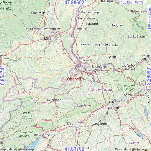
Oberwil GPS coordinates[2]
47° 30' 50.652" North, 7° 33' 28.296" East
| Map corner | latitude | longitude |
|---|---|---|
| Upper-left | 47.98682°, | 6.85474° |
| Center: | 47.51407°, | 7.55786° |
| Lower-right: | 47.03702°, | 8.26099° |
| Map W x H: | 105.6×105.6 km | = 65.6×65.6mi |
| max Lat: | 47.76737° ⇑8.6% North |
| Oberwil: | 47.51407° |
| min Lat: | ⇓91.4% South 45.83203° |
| min Long | Oberwil | max Long |
| 5.97153° | 7.55786° | 10.44624° |
| W 26.6%⇐ | ⇒73.4% E |
Elevation
Elevation of Oberwil is 299 m = 981 ft, and this is 259.2 m = 850 ft below average elevation for this country.
| Max E: |
1845 m = 6053 ft | 97.4% |
| Avg. | 558.2 m = 1831 ft | |
| Oberwil | 299 m = 981 ft | |
Min E: |
197 m = 646 ft | 2.6% |
See also: Switzerland elevation on elevation.city.
Geographical zone
Oberwil is located in North temperate zone (between Tropic of Cancer and the Arctic Circle). Distance of this North polar circle is 2118.1 km =1316.1 mi to North.| Distance of | km | miles | from Oberwil |
|---|---|---|---|
| North Pole | 4724 | 2935.4 | to North |
| Arctic Circle | 2118.1 | 1316.1 | to North |
| Tropic Cancer | 2677.2 | 1663.5 | to South |
| Equator | 5283.1 | 3282.8 | to South |


Nearby cities:
15 places around Oberwil: (largest is in red/bold)
• Aesch
5.6 km =3.5 mi,  148°
148°
• Allschwil
4.4 km =2.7 mi,  338°
338°
• Arlesheim
5.2 km =3.2 mi,  115°
115°
• Basel
5.1 km =3.2 mi,  13°
13°
• Binningen
3 km =1.9 mi,  16°
16°
• Birsfelden
6.5 km =4 mi,  48°
48°
• Blauen
7.7 km =4.8 mi,  202°
202°
• Bottmingen
1.5 km =0.9 mi, 45°
• Dornach
5.8 km =3.6 mi,  130°
130°
• Ettingen
3.6 km =2.2 mi,  193°
193°
• Muttenz
6.6 km =4.1 mi,  81°
81°
• Münchenstein
3.9 km =2.4 mi, 82°
• Pfeffingen
6.5 km =4 mi,  158°
158°
• Schönenbuch
4.8 km =3 mi,  304°
304°
• Therwil
1.6 km =1 mi,  183°
183°
Sources, notices
• [Note1] Compared only with cities in Switzerland existing in our database
• [Src1] Map data: © OpenStreetMap contributors (CC-BY-SA)
• [Src2] Other city data from geonames.org with taken over terms of usage.
• [Src3] Geographical zone / Annual Mean Temperature by Robert A. Rohde @ Wikipedia
