Ettingen geodata
Ettingen (Basel-Landschaft) is a populated place; located in Switzerland in Europe/Zurich (GMT+2) time zone. With population of 4,980 people, there are 346 cities with bigger population in this country. Compared to other cities in Switzerland, 86.8% of cities are located further ↓South; 73.8% of cities are located further →East and 96.1% of cities have higher elevation than Ettingen. Note1


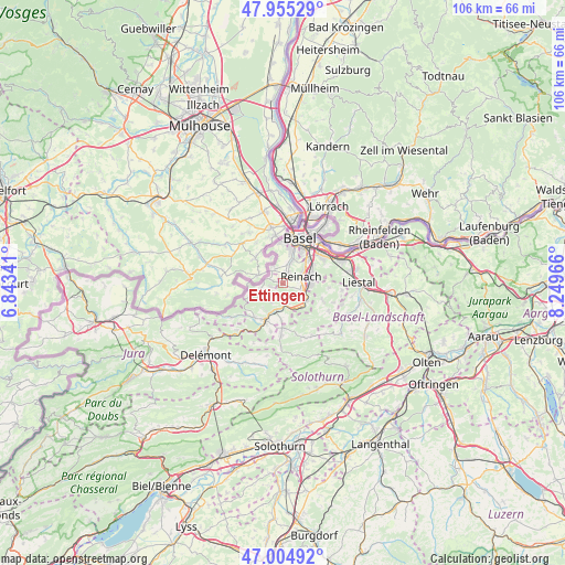
Ettingen GPS coordinates[2]
47° 28' 56.1" North, 7° 32' 47.544" East
| Map corner | latitude | longitude |
|---|---|---|
| Upper-left | 47.95529°, | 6.84341° |
| Center: | 47.48225°, | 7.54654° |
| Lower-right: | 47.00492°, | 8.24966° |
| Map W x H: | 105.7×105.7 km | = 65.7×65.7mi |
| max Lat: | 47.76737° ⇑13.2% North |
| Ettingen: | 47.48225° |
| min Lat: | ⇓86.8% South 45.83203° |
| min Long | Ettingen | max Long |
| 5.97153° | 7.54654° | 10.44624° |
| W 26.2%⇐ | ⇒73.8% E |
Elevation
Elevation of Ettingen is 333 m = 1093 ft, and this is 225.2 m = 739 ft below average elevation for this country.
| Max E: |
1845 m = 6053 ft | 96.1% |
| Avg. | 558.2 m = 1831 ft | |
| Ettingen | 333 m = 1093 ft | |
Min E: |
197 m = 646 ft | 3.9% |
See also: Switzerland elevation on elevation.city.
Geographical zone
Ettingen is located in North temperate zone (between Tropic of Cancer and the Arctic Circle). Distance of this North polar circle is 2121.6 km =1318.3 mi to North.| Distance of | km | miles | from Ettingen |
|---|---|---|---|
| North Pole | 4727.5 | 2937.5 | to North |
| Arctic Circle | 2121.6 | 1318.3 | to North |
| Tropic Cancer | 2673.6 | 1661.3 | to South |
| Equator | 5279.5 | 3280.5 | to South |


Nearby cities:
15 places around Ettingen: (largest is in red/bold)
• Aesch
4 km =2.5 mi,  108°
108°
• Arlesheim
5.7 km =3.5 mi,  76°
76°
• Binningen
6.7 km =4.2 mi,  14°
14°
• Blauen
4.1 km =2.5 mi,  209°
209°
• Bottmingen
5 km =3.1 mi,  22°
22°
• Brislach
7.2 km =4.5 mi,  181°
181°
• Dornach
5.3 km =3.3 mi,  92°
92°
• Grellingen
5.5 km =3.4 mi,  144°
144°
• Münchenstein
6.2 km =3.9 mi,  49°
49°
• Oberwil
3.6 km =2.2 mi, 13°
• Pfeffingen
4.1 km =2.5 mi,  127°
127°
• Rodersdorf
6.7 km =4.2 mi,  268°
268°
• Schönenbuch
7 km =4.3 mi,  333°
333°
• Therwil
2.1 km =1.3 mi, 21°
• Zwingen
5 km =3.1 mi,  194°
194°
Sources, notices
• [Note1] Compared only with cities in Switzerland existing in our database
• [Src1] Map data: © OpenStreetMap contributors (CC-BY-SA)
• [Src2] Other city data from geonames.org with taken over terms of usage.
• [Src3] Geographical zone / Annual Mean Temperature by Robert A. Rohde @ Wikipedia
