Muttenz geodata
Muttenz (Basel-Landschaft) is a populated place; located in Switzerland in Europe/Zurich (GMT+2) time zone. With population of 16,927 people, there are 57 cities with bigger population in this country. Compared to other cities in Switzerland, 92.5% of cities are located further ↓South; 70.1% of cities are located further →East and 97.6% of cities have higher elevation than Muttenz. Note1


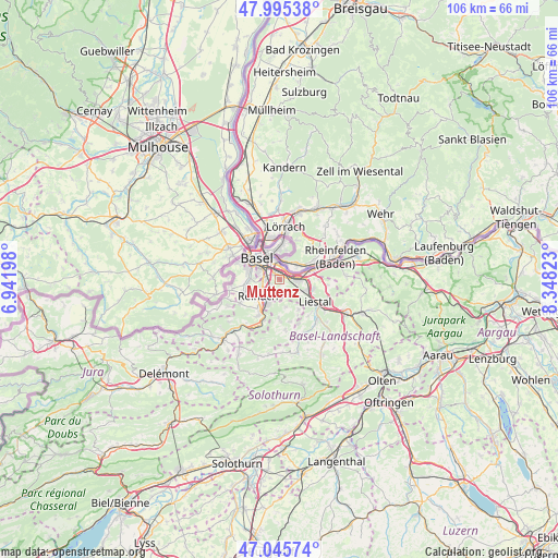
Muttenz GPS coordinates[2]
47° 31' 21.756" North, 7° 38' 42.396" East
| Map corner | latitude | longitude |
|---|---|---|
| Upper-left | 47.99538°, | 6.94198° |
| Center: | 47.52271°, | 7.64511° |
| Lower-right: | 47.04574°, | 8.34823° |
| Map W x H: | 105.6×105.6 km | = 65.6×65.6mi |
| max Lat: | 47.76737° ⇑7.5% North |
| Muttenz: | 47.52271° |
| min Lat: | ⇓92.5% South 45.83203° |
| min Long | Muttenz | max Long |
| 5.97153° | 7.64511° | 10.44624° |
| W 29.9%⇐ | ⇒70.1% E |
Elevation
Elevation of Muttenz is 293 m = 961 ft, and this is 265.2 m = 870 ft below average elevation for this country.
| Max E: |
1845 m = 6053 ft | 97.6% |
| Avg. | 558.2 m = 1831 ft | |
| Muttenz | 293 m = 961 ft | |
Min E: |
197 m = 646 ft | 2.4% |
See also: Switzerland elevation on elevation.city.
Geographical zone
Muttenz is located in North temperate zone (between Tropic of Cancer and the Arctic Circle). Distance of this North polar circle is 2117.1 km =1315.5 mi to North.| Distance of | km | miles | from Muttenz |
|---|---|---|---|
| North Pole | 4723 | 2934.7 | to North |
| Arctic Circle | 2117.1 | 1315.5 | to North |
| Tropic Cancer | 2678.1 | 1664.1 | to South |
| Equator | 5284 | 3283.3 | to South |


Nearby cities:
15 places around Muttenz: (largest is in red/bold)
• Arlesheim
3.7 km =2.3 mi,  210°
210°
• Augst
5.4 km =3.4 mi,  74°
74°
• Bettingen
5.5 km =3.4 mi,  15°
15°
• Binningen
6 km =3.7 mi,  288°
288°
• Birsfelden
3.7 km =2.3 mi,  333°
333°
• Bottmingen
5.5 km =3.4 mi,  270°
270°
• Dornach
5.2 km =3.2 mi,  204°
204°
• Frenkendorf
5.6 km =3.5 mi,  108°
108°
• Füllinsdorf
6.7 km =4.2 mi, 105°
• Gempen
5.3 km =3.3 mi,  167°
167°
• Kaiseraugst
6.4 km =4 mi, 72°
• Münchenstein
2.7 km =1.7 mi,  259°
259°
• Oberwil
6.6 km =4.1 mi, 261°
• Pratteln
3.6 km =2.2 mi,  93°
93°
• Riehen
6.2 km =3.9 mi,  1°
1°
Sources, notices
• [Note1] Compared only with cities in Switzerland existing in our database
• [Src1] Map data: © OpenStreetMap contributors (CC-BY-SA)
• [Src2] Other city data from geonames.org with taken over terms of usage.
• [Src3] Geographical zone / Annual Mean Temperature by Robert A. Rohde @ Wikipedia
