Oberdiessbach geodata
Oberdiessbach (Bern) is a populated place; located in Switzerland in Europe/Zurich (GMT+2) time zone. With population of 2,860 people, there are 614 cities with bigger population in this country. Compared to other cities in Switzerland, 72.2% of cities are located further ↑North; 71.2% of cities are located further →East and 76% of cities have lower elevation than Oberdiessbach. Note1


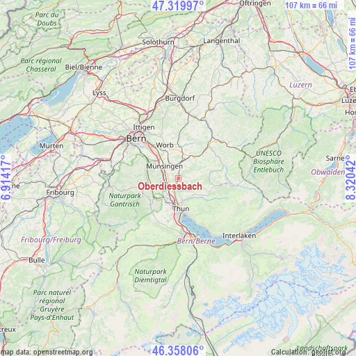
Oberdiessbach GPS coordinates[2]
46° 50' 28.212" North, 7° 37' 2.28" East
| Map corner | latitude | longitude |
|---|---|---|
| Upper-left | 47.31997°, | 6.91417° |
| Center: | 46.84117°, | 7.6173° |
| Lower-right: | 46.35806°, | 8.32042° |
| Map W x H: | 107×107 km | = 66.5×66.5mi |
| max Lat: | 47.76737° ⇑72.2% North |
| Oberdiessbach: | 46.84117° |
| min Lat: | ⇓27.8% South 45.83203° |
| min Long | Oberdiessbach | max Long |
| 5.97153° | 7.6173° | 10.44624° |
| W 28.8%⇐ | ⇒71.2% E |
Elevation
Elevation of Oberdiessbach is 626 m = 2054 ft, and this is 67.8 m = 222 ft above average elevation for this country.
| Max E: |
1845 m = 6053 ft | 24% |
| Oberdiessbach | 626 m 2054 ft | |
| Avg. | 558.2 m = 1831 ft | |
Min E: |
197 m = 646 ft | 76% |
See also: Switzerland elevation on elevation.city.
Geographical zone
Oberdiessbach is located in North temperate zone (between Tropic of Cancer and the Arctic Circle). Distance of this North polar circle is 2192.9 km =1362.6 mi to North.| Distance of | km | miles | from Oberdiessbach |
|---|---|---|---|
| North Pole | 4798.8 | 2981.8 | to North |
| Arctic Circle | 2192.9 | 1362.6 | to North |
| Tropic Cancer | 2602.3 | 1617 | to South |
| Equator | 5208.2 | 3236.2 | to South |


Nearby cities:
15 places around Oberdiessbach: (largest is in red/bold)
• Buchholterberg
5.3 km =3.3 mi,  125°
125°
• Fahrni
6 km =3.7 mi,  151°
151°
• Gerzensee
5.5 km =3.4 mi,  268°
268°
• Heimberg
5.2 km =3.2 mi,  190°
190°
• Kiesen
3.5 km =2.2 mi,  226°
226°
• Kirchdorf
5.7 km =3.5 mi,  246°
246°
• Konolfingen
4.2 km =2.6 mi,  2°
2°
• Linden
4.7 km =2.9 mi,  82°
82°
• Münsingen
5.6 km =3.5 mi,  309°
309°
• Oberhünigen
5.3 km =3.3 mi,  34°
34°
• Steffisburg
7.1 km =4.4 mi,  170°
170°
• Tägertschi
4.5 km =2.8 mi,  327°
327°
• Uttigen
6 km =3.7 mi,  209°
209°
• Wichtrach
3.2 km =2 mi,  288°
288°
• Zäziwil
7.6 km =4.7 mi, 26°
Sources, notices
• [Note1] Compared only with cities in Switzerland existing in our database
• [Src1] Map data: © OpenStreetMap contributors (CC-BY-SA)
• [Src2] Other city data from geonames.org with taken over terms of usage.
• [Src3] Geographical zone / Annual Mean Temperature by Robert A. Rohde @ Wikipedia
