Linden geodata
Linden (Bern) is a populated place; located in Switzerland in Europe/Zurich (GMT+2) time zone. With population of 1,315 people, there are 1127 cities with bigger population in this country. Compared to other cities in Switzerland, 72.1% of cities are located further ↑North; 68.9% of cities are located further →East and 92.7% of cities have lower elevation than Linden. Note1


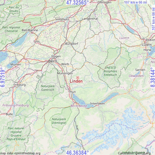
Linden GPS coordinates[2]
46° 50' 48.84" North, 7° 40' 41.916" East
| Map corner | latitude | longitude |
|---|---|---|
| Upper-left | 47.32565°, | 6.97519° |
| Center: | 46.8469°, | 7.67831° |
| Lower-right: | 46.36384°, | 8.38144° |
| Map W x H: | 106.9×106.9 km | = 66.4×66.4mi |
| max Lat: | 47.76737° ⇑72.1% North |
| Linden: | 46.8469° |
| min Lat: | ⇓27.9% South 45.83203° |
| min Long | Linden | max Long |
| 5.97153° | 7.67831° | 10.44624° |
| W 31.1%⇐ | ⇒68.9% E |
Elevation
Elevation of Linden is 918 m = 3012 ft, and this is 359.8 m = 1180 ft above average elevation for this country.
| Max E: |
1845 m = 6053 ft | 7.3% |
| Linden | 918 m 3012 ft | |
| Avg. | 558.2 m = 1831 ft | |
Min E: |
197 m = 646 ft | 92.7% |
See also: Switzerland elevation on elevation.city.
Geographical zone
Linden is located in North temperate zone (between Tropic of Cancer and the Arctic Circle). Distance of this North polar circle is 2192.3 km =1362.2 mi to North.| Distance of | km | miles | from Linden |
|---|---|---|---|
| North Pole | 4798.2 | 2981.5 | to North |
| Arctic Circle | 2192.3 | 1362.2 | to North |
| Tropic Cancer | 2603 | 1617.4 | to South |
| Equator | 5208.9 | 3236.7 | to South |


Nearby cities:
15 places around Linden: (largest is in red/bold)
• Bowil
5.3 km =3.3 mi,  15°
15°
• Buchholterberg
3.7 km =2.3 mi,  184°
184°
• Eggiwil
9.5 km =5.9 mi,  70°
70°
• Fahrni
6.1 km =3.8 mi,  196°
196°
• Heimberg
8.1 km =5 mi,  224°
224°
• Kiesen
7.8 km =4.8 mi,  247°
247°
• Konolfingen
5.7 km =3.5 mi,  308°
308°
• Münsingen
9.4 km =5.8 mi,  288°
288°
• Oberdiessbach
4.7 km =2.9 mi,  262°
262°
• Oberhünigen
4.1 km =2.5 mi,  336°
336°
• Signau
8.8 km =5.5 mi, 23°
• Steffisburg
8.4 km =5.2 mi, 204°
• Tägertschi
7.8 km =4.8 mi, 294°
• Wichtrach
7.7 km =4.8 mi,  272°
272°
• Zäziwil
6.2 km =3.9 mi,  348°
348°
Sources, notices
• [Note1] Compared only with cities in Switzerland existing in our database
• [Src1] Map data: © OpenStreetMap contributors (CC-BY-SA)
• [Src2] Other city data from geonames.org with taken over terms of usage.
• [Src3] Geographical zone / Annual Mean Temperature by Robert A. Rohde @ Wikipedia
