Oberburg geodata
Oberburg (Bern) is a populated place; located in Switzerland in Europe/Zurich (GMT+2) time zone. With population of 2,901 people, there are 603 cities with bigger population in this country. Compared to other cities in Switzerland, 62.4% of cities are located further ↑North; 70.5% of cities are located further →East and 66.2% of cities have lower elevation than Oberburg. Note1


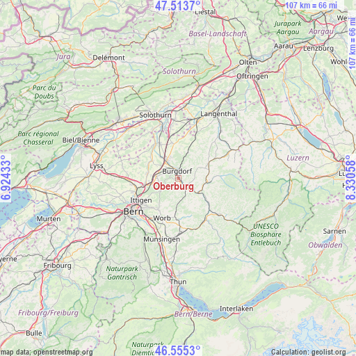
Oberburg GPS coordinates[2]
47° 2' 11.94" North, 7° 37' 38.82" East
| Map corner | latitude | longitude |
|---|---|---|
| Upper-left | 47.5137°, | 6.92433° |
| Center: | 47.03665°, | 7.62745° |
| Lower-right: | 46.5553°, | 8.33058° |
| Map W x H: | 106.6×106.6 km | = 66.2×66.2mi |
| max Lat: | 47.76737° ⇑62.4% North |
| Oberburg: | 47.03665° |
| min Lat: | ⇓37.6% South 45.83203° |
| min Long | Oberburg | max Long |
| 5.97153° | 7.62745° | 10.44624° |
| W 29.5%⇐ | ⇒70.5% E |
Elevation
Elevation of Oberburg is 551 m = 1808 ft, and this is 7.2 m = 24 ft below average elevation for this country.
| Max E: |
1845 m = 6053 ft | 33.8% |
| Avg. | 558.2 m = 1831 ft | |
| Oberburg | 551 m = 1808 ft | |
Min E: |
197 m = 646 ft | 66.2% |
See also: Switzerland elevation on elevation.city.
Geographical zone
Oberburg is located in North temperate zone (between Tropic of Cancer and the Arctic Circle). Distance of this North polar circle is 2171.2 km =1349.1 mi to North.| Distance of | km | miles | from Oberburg |
|---|---|---|---|
| North Pole | 4777.1 | 2968.4 | to North |
| Arctic Circle | 2171.2 | 1349.1 | to North |
| Tropic Cancer | 2624.1 | 1630.5 | to South |
| Equator | 5230 | 3249.8 | to South |


Nearby cities:
15 places around Oberburg: (largest is in red/bold)
• Burgdorf
2.5 km =1.6 mi,  0°
0°
• Bäriswil
7.8 km =4.8 mi,  255°
255°
• Ersigen
6.8 km =4.2 mi,  338°
338°
• Heimiswil
4.5 km =2.8 mi,  40°
40°
• Hindelbank
6.6 km =4.1 mi,  275°
275°
• Jegenstorf
9.1 km =5.7 mi, 277°
• Kirchberg
6.4 km =4 mi,  328°
328°
• Krauchthal
5.5 km =3.4 mi,  237°
237°
• Lyssach
4.6 km =2.9 mi,  312°
312°
• Lützelflüh
5.8 km =3.6 mi,  123°
123°
• Rüegsau
3.8 km =2.4 mi,  110°
110°
• Rüti bei Lyssach
4.4 km =2.7 mi,  300°
300°
• Sumiswald
9 km =5.6 mi,  96°
96°
• Trachselwald
8.5 km =5.3 mi, 104°
• Wynigen
8.3 km =5.2 mi,  21°
21°
Sources, notices
• [Note1] Compared only with cities in Switzerland existing in our database
• [Src1] Map data: © OpenStreetMap contributors (CC-BY-SA)
• [Src2] Other city data from geonames.org with taken over terms of usage.
• [Src3] Geographical zone / Annual Mean Temperature by Robert A. Rohde @ Wikipedia
