Trachselwald geodata
Trachselwald (Bern) is a populated place; located in Switzerland in Europe/Zurich (GMT+2) time zone. With population of 1,068 people, there are 1283 cities with bigger population in this country. Compared to other cities in Switzerland, 63.6% of cities are located further ↑North; 67.4% of cities are located further →East and 81.5% of cities have lower elevation than Trachselwald. Note1


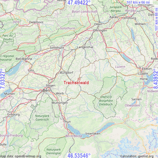
Trachselwald GPS coordinates[2]
47° 1' 1.164" North, 7° 44' 11.004" East
| Map corner | latitude | longitude |
|---|---|---|
| Upper-left | 47.49422°, | 7.03327° |
| Center: | 47.01699°, | 7.73639° |
| Lower-right: | 46.53546°, | 8.43952° |
| Map W x H: | 106.6×106.6 km | = 66.2×66.2mi |
| max Lat: | 47.76737° ⇑63.6% North |
| Trachselwald: | 47.01699° |
| min Lat: | ⇓36.4% South 45.83203° |
| min Long | Trachselwald | max Long |
| 5.97153° | 7.73639° | 10.44624° |
| W 32.6%⇐ | ⇒67.4% E |
Elevation
Elevation of Trachselwald is 683 m = 2241 ft, and this is 124.8 m = 409 ft above average elevation for this country.
| Max E: |
1845 m = 6053 ft | 18.5% |
| Trachselwald | 683 m 2241 ft | |
| Avg. | 558.2 m = 1831 ft | |
Min E: |
197 m = 646 ft | 81.5% |
See also: Switzerland elevation on elevation.city.
Geographical zone
Trachselwald is located in North temperate zone (between Tropic of Cancer and the Arctic Circle). Distance of this North polar circle is 2173.4 km =1350.5 mi to North.| Distance of | km | miles | from Trachselwald |
|---|---|---|---|
| North Pole | 4779.3 | 2969.7 | to North |
| Arctic Circle | 2173.4 | 1350.5 | to North |
| Tropic Cancer | 2621.9 | 1629.2 | to South |
| Equator | 5227.8 | 3248.4 | to South |


Nearby cities:
15 places around Trachselwald: (largest is in red/bold)
• Arni
10.6 km =6.6 mi,  210°
210°
• Burgdorf
9.5 km =5.9 mi,  299°
299°
• Dürrenroth
9.1 km =5.7 mi,  27°
27°
• Heimiswil
7.7 km =4.8 mi,  316°
316°
• Landiswil
7.8 km =4.8 mi, 213°
• Langnau
9.5 km =5.9 mi,  155°
155°
• Lauperswil
5.7 km =3.5 mi,  175°
175°
• Lützelflüh
3.5 km =2.2 mi,  252°
252°
• Oberburg
8.5 km =5.3 mi,  284°
284°
• Rüderswil
3.9 km =2.4 mi,  196°
196°
• Rüegsau
4.8 km =3 mi, 280°
• Signau
10.9 km =6.8 mi, 184°
• Sumiswald
1.3 km =0.8 mi, 29°
• Walterswil
11 km =6.8 mi,  16°
16°
• Wyssachen
9.8 km =6.1 mi,  45°
45°
Sources, notices
• [Note1] Compared only with cities in Switzerland existing in our database
• [Src1] Map data: © OpenStreetMap contributors (CC-BY-SA)
• [Src2] Other city data from geonames.org with taken over terms of usage.
• [Src3] Geographical zone / Annual Mean Temperature by Robert A. Rohde @ Wikipedia
