Neftenbach / Dorf Neftenbach geodata
Neftenbach / Dorf Neftenbach (Zurich) is a section of populated place; located in Switzerland in Europe/Zurich (GMT+2) time zone. With population of 3,171 people, there are 557 cities with bigger population in this country. Compared to other cities in Switzerland, 93% of cities are located further ↓South; 71.4% of cities are located further ←West and 83.4% of cities have higher elevation than Neftenbach / Dorf Neftenbach. Note1
Current local time in Neftenbach / Dorf Neftenbach:
08:51 AM, SaturdayDifference from your time zone: hours


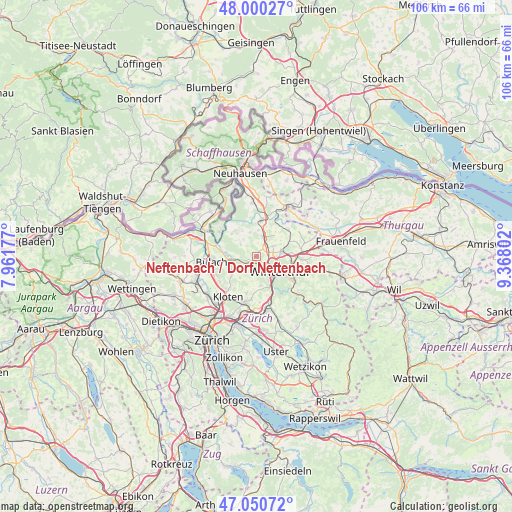
Neftenbach / Dorf Neftenbach GPS coordinates[2]
47° 31' 39.504" North, 8° 39' 53.64" East
| Map corner | latitude | longitude |
|---|---|---|
| Upper-left | 48.00027°, | 7.96177° |
| Center: | 47.52764°, | 8.6649° |
| Lower-right: | 47.05072°, | 9.36802° |
| Map W x H: | 105.6×105.6 km | = 65.6×65.6mi |
| max Lat: | 47.76737° ⇑7% North |
| Neftenbach / Dorf Neftenbach: | 47.52764° |
| min Lat: | ⇓93% South 45.83203° |
| min Long | Neftenbach / Do | max Long |
| 5.97153° | 8.6649° | 10.44624° |
| W 71.4%⇐ | ⇒28.6% E |
Elevation
Elevation of Neftenbach / Dorf Neftenbach is 414 m = 1358 ft, and this is 144.2 m = 473 ft below average elevation for this country.
| Max E: |
1845 m = 6053 ft | 83.4% |
| Avg. | 558.2 m = 1831 ft | |
| Neftenbach / Dorf Neftenbach | 414 m = 1358 ft | |
Min E: |
197 m = 646 ft | 16.6% |
See also: Switzerland elevation on elevation.city.
Geographical zone
Neftenbach / Dorf Neftenbach is located in North temperate zone (between Tropic of Cancer and the Arctic Circle). Distance of this North polar circle is 2116.6 km =1315.2 mi to North.| Distance of | km | miles | from Neftenbach / Dorf Neftenbach |
|---|---|---|---|
| North Pole | 4722.5 | 2934.4 | to North |
| Arctic Circle | 2116.6 | 1315.2 | to North |
| Tropic Cancer | 2678.7 | 1664.5 | to South |
| Equator | 5284.6 | 3283.7 | to South |


Nearby cities:
15 places around Neftenbach / Dorf Neftenbach: (largest is in red/bold)
• Henggart
4.1 km =2.5 mi,  18°
18°
• Hettlingen
3.7 km =2.3 mi,  55°
55°
• Hettlingen / Dorfkern
3.8 km =2.4 mi, 55°
• Hettlingen / Gübel
4.4 km =2.7 mi, 59°
• Ober-Ohringen
3.7 km =2.3 mi,  91°
91°
• Pfungen
2.3 km =1.4 mi,  228°
228°
• Veltheim (Kreis 5)
4.2 km =2.6 mi,  110°
110°
• Veltheim (Kreis 5) / Blumenau
4.5 km =2.8 mi,  122°
122°
• Veltheim (Kreis 5) / Rosenberg
4.1 km =2.5 mi, 111°
• Wülflingen (Kreis 6)
2.4 km =1.5 mi,  144°
144°
• Wülflingen (Kreis 6) / Härti
2.2 km =1.4 mi, 139°
• Wülflingen (Kreis 6) / Lindenplatz
2.8 km =1.7 mi,  131°
131°
• Wülflingen (Kreis 6) / Niederfeld
2.3 km =1.4 mi,  151°
151°
• Wülflingen (Kreis 6) / Oberfeld
4.1 km =2.5 mi, 141°
• Wülflingen (Kreis 6) / Weinberg
3.3 km =2.1 mi, 124°
Sources, notices
• [Note1] Compared only with cities in Switzerland existing in our database
• [Src1] Map data: © OpenStreetMap contributors (CC-BY-SA)
• [Src2] Other city data from geonames.org with taken over terms of usage.
• [Src3] Geographical zone / Annual Mean Temperature by Robert A. Rohde @ Wikipedia
