Obfelden / Bickwil geodata
Obfelden / Bickwil (Zurich) is a section of populated place; located in Switzerland in Europe/Zurich (GMT+2) time zone. With population of 733 people, there are 1555 cities with bigger population in this country. Compared to other cities in Switzerland, 54.3% of cities are located further ↓South; 51.2% of cities are located further ←West and 60.3% of cities have higher elevation than Obfelden / Bickwil. Note1


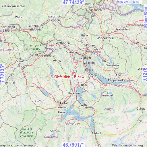
Obfelden / Bickwil GPS coordinates[2]
47° 16' 9.948" North, 8° 25' 28.128" East
| Map corner | latitude | longitude |
|---|---|---|
| Upper-left | 47.74439°, | 7.72135° |
| Center: | 47.26943°, | 8.42448° |
| Lower-right: | 46.79017°, | 9.1276° |
| Map W x H: | 106.1×106.1 km | = 65.9×65.9mi |
| max Lat: | 47.76737° ⇑45.7% North |
| Obfelden / Bickwil: | 47.26943° |
| min Lat: | ⇓54.3% South 45.83203° |
| min Long | Obfelden / Bick | max Long |
| 5.97153° | 8.42448° | 10.44624° |
| W 51.2%⇐ | ⇒48.8% E |
Elevation
Elevation of Obfelden / Bickwil is 454 m = 1490 ft, and this is 104.2 m = 342 ft below average elevation for this country.
| Max E: |
1845 m = 6053 ft | 60.3% |
| Avg. | 558.2 m = 1831 ft | |
| Obfelden / Bickwil | 454 m = 1490 ft | |
Min E: |
197 m = 646 ft | 39.7% |
See also: Switzerland elevation on elevation.city.
Geographical zone
Obfelden / Bickwil is located in North temperate zone (between Tropic of Cancer and the Arctic Circle). Distance of this North polar circle is 2145.3 km =1333 mi to North.| Distance of | km | miles | from Obfelden / Bickwil |
|---|---|---|---|
| North Pole | 4751.2 | 2952.3 | to North |
| Arctic Circle | 2145.3 | 1333 | to North |
| Tropic Cancer | 2649.9 | 1646.6 | to South |
| Equator | 5255.9 | 3265.9 | to South |


Nearby cities:
15 places around Obfelden / Bickwil: (largest is in red/bold)
• Affoltern / Butzen
2.6 km =1.6 mi,  71°
71°
• Affoltern / Goldiger Berg
1.9 km =1.2 mi,  56°
56°
• Affoltern / Hasenbüel
2.1 km =1.3 mi,  78°
78°
• Affoltern / Oberdorf
2.6 km =1.6 mi, 67°
• Affoltern / Sonnenberg
3 km =1.9 mi, 65°
• Affoltern / Unterdorf
2.7 km =1.7 mi, 56°
• Affoltern am Albis
2.2 km =1.4 mi, 66°
• Hedingen
3.6 km =2.2 mi,  29°
29°
• Jonen
3.9 km =2.4 mi,  322°
322°
• Merenschwand
3.8 km =2.4 mi,  252°
252°
• Obfelden
0.6 km =0.4 mi,  200°
200°
• Obfelden / Oberlunnern
1.1 km =0.7 mi,  218°
218°
• Obfelden / Toussen
0.6 km =0.4 mi,  133°
133°
• Ottenbach
2.1 km =1.3 mi,  313°
313°
• Zwillikon
2.2 km =1.4 mi,  13°
13°
Sources, notices
• [Note1] Compared only with cities in Switzerland existing in our database
• [Src1] Map data: © OpenStreetMap contributors (CC-BY-SA)
• [Src2] Other city data from geonames.org with taken over terms of usage.
• [Src3] Geographical zone / Annual Mean Temperature by Robert A. Rohde @ Wikipedia
