Menzingen geodata
Menzingen (Zug) is a populated place; located in Switzerland in Europe/Zurich (GMT+2) time zone. With population of 3,878 people, there are 456 cities with bigger population in this country. Compared to other cities in Switzerland, 54.4% of cities are located further ↑North; 65.7% of cities are located further ←West and 89.1% of cities have lower elevation than Menzingen. Note1


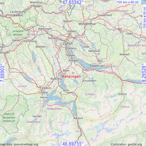
Menzingen GPS coordinates[2]
47° 10' 39.504" North, 8° 35' 31.74" East
| Map corner | latitude | longitude |
|---|---|---|
| Upper-left | 47.65342°, | 7.88903° |
| Center: | 47.17764°, | 8.59215° |
| Lower-right: | 46.69755°, | 9.29528° |
| Map W x H: | 106.3×106.3 km | = 66.1×66.1mi |
| max Lat: | 47.76737° ⇑54.4% North |
| Menzingen: | 47.17764° |
| min Lat: | ⇓45.6% South 45.83203° |
| min Long | Menzingen | max Long |
| 5.97153° | 8.59215° | 10.44624° |
| W 65.7%⇐ | ⇒34.3% E |
Elevation
Elevation of Menzingen is 806 m = 2644 ft, and this is 247.8 m = 813 ft above average elevation for this country.
| Max E: |
1845 m = 6053 ft | 10.9% |
| Menzingen | 806 m 2644 ft | |
| Avg. | 558.2 m = 1831 ft | |
Min E: |
197 m = 646 ft | 89.1% |
See also: Switzerland elevation on elevation.city.
Geographical zone
Menzingen is located in North temperate zone (between Tropic of Cancer and the Arctic Circle). Distance of this North polar circle is 2155.5 km =1339.4 mi to North.| Distance of | km | miles | from Menzingen |
|---|---|---|---|
| North Pole | 4761.4 | 2958.6 | to North |
| Arctic Circle | 2155.5 | 1339.4 | to North |
| Tropic Cancer | 2639.7 | 1640.2 | to South |
| Equator | 5245.7 | 3259.5 | to South |


Nearby cities:
15 places around Menzingen: (largest is in red/bold)
• Au
8.1 km =5 mi,  28°
28°
• Au / Mittel-Dorf
8.3 km =5.2 mi, 29°
• Au / Unter-Dorf
8.3 km =5.2 mi,  21°
21°
• Baar
5.2 km =3.2 mi,  293°
293°
• Horgen / Allmend
7.8 km =4.8 mi,  8°
8°
• Samstagern
7 km =4.3 mi,  77°
77°
• Unterägeri
4.6 km =2.9 mi,  186°
186°
• Wädenswil
8 km =5 mi,  46°
46°
• Wädenswil / Büelen
8.3 km =5.2 mi,  40°
40°
• Wädenswil / Dorf (Wädenswil)
8.3 km =5.2 mi, 46°
• Wädenswil / Eichweid
7.7 km =4.8 mi, 53°
• Wädenswil / Hangenmoos
7.7 km =4.8 mi, 36°
• Wädenswil / Leihof-Mühlebach
7.9 km =4.9 mi, 49°
• Wädenswil / Untermosen-Fuhr
7.7 km =4.8 mi, 43°
• Zug
5.7 km =3.5 mi,  264°
264°
Sources, notices
• [Note1] Compared only with cities in Switzerland existing in our database
• [Src1] Map data: © OpenStreetMap contributors (CC-BY-SA)
• [Src2] Other city data from geonames.org with taken over terms of usage.
• [Src3] Geographical zone / Annual Mean Temperature by Robert A. Rohde @ Wikipedia
