Münchenwiler geodata
Münchenwiler (Bern) is a seat of a third-order administrative division; located in Switzerland in Europe/Zurich (GMT+2) time zone. In our database, there are 1823 cities with bigger population. Compared to other cities in Switzerland, 68.7% of cities are located further ↑North; 84.2% of cities are located further →East and 58.8% of cities have lower elevation than Münchenwiler. Note1
Administrative division(s):
- Level 1: Bern
- Level 2: Bern-Mittelland District
- Level 3: Münchenwiler/Villars-Les-Moines


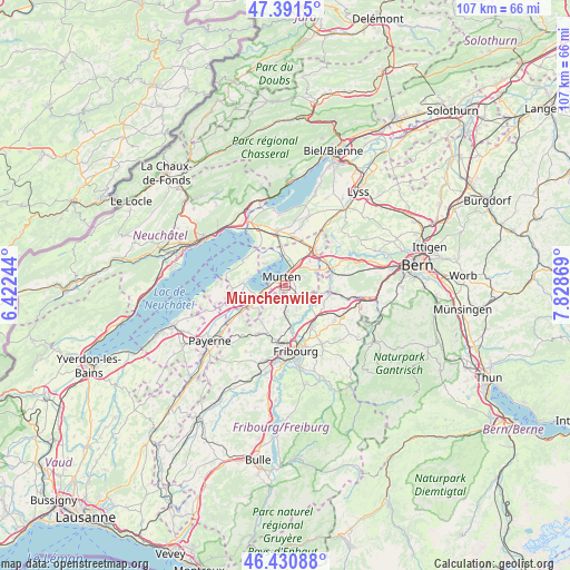
Münchenwiler GPS coordinates[2]
46° 54' 48.024" North, 7° 7' 32.016" East
| Map corner | latitude | longitude |
|---|---|---|
| Upper-left | 47.3915°, | 6.42244° |
| Center: | 46.91334°, | 7.12556° |
| Lower-right: | 46.43088°, | 7.82869° |
| Map W x H: | 106.8×106.8 km | = 66.4×66.4mi |
| max Lat: | 47.76737° ⇑68.7% North |
| Münchenwiler: | 46.91334° |
| min Lat: | ⇓31.3% South 45.83203° |
| min Long | Münchenwiler | max Long |
| 5.97153° | 7.12556° | 10.44624° |
| W 15.8%⇐ | ⇒84.2% E |
Elevation
Elevation of Münchenwiler is 512 m = 1680 ft, and this is 46.2 m = 152 ft below average elevation for this country.
| Max E: |
1845 m = 6053 ft | 41.2% |
| Avg. | 558.2 m = 1831 ft | |
| Münchenwiler | 512 m = 1680 ft | |
Min E: |
197 m = 646 ft | 58.8% |
See also: Switzerland elevation on elevation.city.
Geographical zone
Münchenwiler is located in North temperate zone (between Tropic of Cancer and the Arctic Circle). Distance of this North polar circle is 2184.9 km =1357.6 mi to North.| Distance of | km | miles | from Münchenwiler |
|---|---|---|---|
| North Pole | 4790.8 | 2976.9 | to North |
| Arctic Circle | 2184.9 | 1357.6 | to North |
| Tropic Cancer | 2610.4 | 1622 | to South |
| Equator | 5216.3 | 3241.3 | to South |


Nearby cities:
15 places around Münchenwiler: (largest is in red/bold)
• Avenches
7.4 km =4.6 mi,  240°
240°
• Barberêche
6.7 km =4.2 mi,  157°
157°
• Bas-Vully
5.5 km =3.4 mi,  349°
349°
• Bellerive
7.9 km =4.9 mi,  278°
278°
• Bösingen
8.1 km =5 mi,  106°
106°
• Cordast
4.6 km =2.9 mi,  154°
154°
• Courgevaux
1.3 km =0.8 mi,  233°
233°
• Düdingen
8.7 km =5.4 mi,  144°
144°
• Faoug
3.7 km =2.3 mi,  261°
261°
• Ferenbalm
7.6 km =4.7 mi,  58°
58°
• Galmiz
4.6 km =2.9 mi,  32°
32°
• Jeuss
3 km =1.9 mi, 110°
• Kleinbösingen
6.4 km =4 mi, 109°
• Liebistorf
5.4 km =3.4 mi,  95°
95°
• Murten/Morat
1.8 km =1.1 mi,  338°
338°
Sources, notices
• [Note1] Compared only with cities in Switzerland existing in our database
• [Src1] Map data: © OpenStreetMap contributors (CC-BY-SA)
• [Src2] Other city data from geonames.org with taken over terms of usage.
• [Src3] Geographical zone / Annual Mean Temperature by Robert A. Rohde @ Wikipedia
