Liebistorf geodata
Liebistorf (Fribourg) is a populated place; located in Switzerland in Europe/Zurich (GMT+2) time zone. With population of 658 people, there are 1644 cities with bigger population in this country. Compared to other cities in Switzerland, 69.1% of cities are located further ↑North; 82.3% of cities are located further →East and 60.3% of cities have lower elevation than Liebistorf. Note1


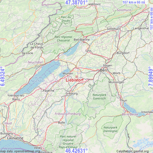
Liebistorf GPS coordinates[2]
46° 54' 31.716" North, 7° 11' 46.896" East
| Map corner | latitude | longitude |
|---|---|---|
| Upper-left | 47.38701°, | 6.49324° |
| Center: | 46.90881°, | 7.19636° |
| Lower-right: | 46.42631°, | 7.89949° |
| Map W x H: | 106.8×106.8 km | = 66.4×66.4mi |
| max Lat: | 47.76737° ⇑69.1% North |
| Liebistorf: | 46.90881° |
| min Lat: | ⇓30.9% South 45.83203° |
| min Long | Liebistorf | max Long |
| 5.97153° | 7.19636° | 10.44624° |
| W 17.7%⇐ | ⇒82.3% E |
Elevation
Elevation of Liebistorf is 520 m = 1706 ft, and this is 38.2 m = 125 ft below average elevation for this country.
| Max E: |
1845 m = 6053 ft | 39.7% |
| Avg. | 558.2 m = 1831 ft | |
| Liebistorf | 520 m = 1706 ft | |
Min E: |
197 m = 646 ft | 60.3% |
See also: Switzerland elevation on elevation.city.
Geographical zone
Liebistorf is located in North temperate zone (between Tropic of Cancer and the Arctic Circle). Distance of this North polar circle is 2185.4 km =1357.9 mi to North.| Distance of | km | miles | from Liebistorf |
|---|---|---|---|
| North Pole | 4791.3 | 2977.2 | to North |
| Arctic Circle | 2185.4 | 1357.9 | to North |
| Tropic Cancer | 2609.9 | 1621.7 | to South |
| Equator | 5215.8 | 3240.9 | to South |


Nearby cities:
15 places around Liebistorf: (largest is in red/bold)
• Barberêche
6.4 km =4 mi,  206°
206°
• Bösingen
3 km =1.9 mi,  127°
127°
• Cordast
5 km =3.1 mi,  222°
222°
• Courgevaux
6.4 km =4 mi,  267°
267°
• Düdingen
6.6 km =4.1 mi,  183°
183°
• Ferenbalm
4.6 km =2.9 mi,  14°
14°
• Galmiz
5.3 km =3.3 mi,  326°
326°
• Jeuss
2.6 km =1.6 mi,  258°
258°
• Kerzers
7.5 km =4.7 mi,  359°
359°
• Kleinbösingen
1.8 km =1.1 mi,  157°
157°
• Laupen
3.4 km =2.1 mi,  102°
102°
• Murten/Morat
6.4 km =4 mi,  289°
289°
• Mühleberg
7.1 km =4.4 mi,  43°
43°
• Münchenwiler
5.4 km =3.4 mi,  275°
275°
• Schmitten
7 km =4.3 mi,  144°
144°
Sources, notices
• [Note1] Compared only with cities in Switzerland existing in our database
• [Src1] Map data: © OpenStreetMap contributors (CC-BY-SA)
• [Src2] Other city data from geonames.org with taken over terms of usage.
• [Src3] Geographical zone / Annual Mean Temperature by Robert A. Rohde @ Wikipedia
