Gsteig geodata
Gsteig (Bern) is a populated place; located in Switzerland in Europe/Zurich (GMT+2) time zone. With population of 946 people, there are 1376 cities with bigger population in this country. Compared to other cities in Switzerland, 79.7% of cities are located further ↑North; 63.2% of cities are located further →East and 74.6% of cities have lower elevation than Gsteig. Note1
Administrative division(s):
- Level 1: Bern
- Level 2: Interlaken-Oberhasli District
- Level 3: Matten bei Interlaken


Gsteig GPS coordinates[2]
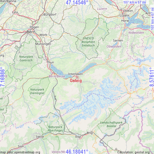
46° 39' 54.324" North, 7° 52' 22.764" East
| Map corner | latitude | longitude |
|---|---|---|
| Upper-left | 47.14546°, | 7.16986° |
| Center: | 46.66509°, | 7.87299° |
| Lower-right: | 46.18041°, | 8.57611° |
| Map W x H: | 107.3×107.3 km | = 66.7×66.7mi |
| max Lat: | 47.76737° ⇑79.7% North |
| Gsteig: | 46.66509° |
| min Lat: | ⇓20.3% South 45.83203° |
| min Long | Gsteig | max Long |
| 5.97153° | 7.87299° | 10.44624° |
| W 36.8%⇐ | ⇒63.2% E |
Elevation
Elevation of Gsteig is 612 m = 2008 ft, and this is 53.8 m = 177 ft above average elevation for this country.
| Max E: |
1845 m = 6053 ft | 25.4% |
| Gsteig | 612 m 2008 ft | |
| Avg. | 558.2 m = 1831 ft | |
Min E: |
197 m = 646 ft | 74.6% |
See also: Switzerland elevation on elevation.city.
Geographical zone
Gsteig is located in North temperate zone (between Tropic of Cancer and the Arctic Circle). Distance of this North polar circle is 2212.5 km =1374.8 mi to North.| Distance of | km | miles | from Gsteig |
|---|---|---|---|
| North Pole | 4818.4 | 2994 | to North |
| Arctic Circle | 2212.5 | 1374.8 | to North |
| Tropic Cancer | 2582.8 | 1604.9 | to South |
| Equator | 5188.7 | 3224.1 | to South |


Nearby cities:
15 places around Gsteig: (largest is in red/bold)
• Aeschi b. Spiez
13.5 km =8.4 mi,  266°
266°
• Beatenberg
7.1 km =4.4 mi,  302°
302°
• Bönigen
2.9 km =1.8 mi,  32°
32°
• Därligen
5 km =3.1 mi, 265°
• Grindelwald
13.3 km =8.3 mi,  110°
110°
• Habkern
6.9 km =4.3 mi,  353°
353°
• Interlaken
2.1 km =1.3 mi, 346°
• Krattigen
11.1 km =6.9 mi, 267°
• Lauterbrunnen
8.5 km =5.3 mi,  160°
160°
• Leissigen
7.5 km =4.7 mi,  261°
261°
• Matten
1.5 km =0.9 mi, 348°
• Ringgenberg
4.3 km =2.7 mi,  22°
22°
• Sigriswil
13.5 km =8.4 mi, 295°
• Unterseen
3 km =1.9 mi,  318°
318°
• Wilderswil
0.9 km =0.6 mi, 259°
Sources, notices
• [Note1] Compared only with cities in Switzerland existing in our database
• [Src1] Map data: © OpenStreetMap contributors (CC-BY-SA)
• [Src2] Other city data from geonames.org with taken over terms of usage.
• [Src3] Geographical zone / Annual Mean Temperature by Robert A. Rohde @ Wikipedia
