Ringgenberg geodata
Ringgenberg (Bern) is a populated place; located in Switzerland in Europe/Zurich (GMT+2) time zone. With population of 2,514 people, there are 692 cities with bigger population in this country. Compared to other cities in Switzerland, 78.3% of cities are located further ↑North; 62.7% of cities are located further →East and 73.6% of cities have lower elevation than Ringgenberg. Note1
Administrative division(s):
- Level 1: Bern
- Level 2: Interlaken-Oberhasli District
- Level 3: Ringgenberg (BE)


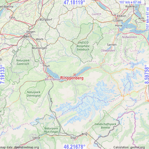
Ringgenberg GPS coordinates[2]
46° 42' 4.104" North, 7° 53' 40.02" East
| Map corner | latitude | longitude |
|---|---|---|
| Upper-left | 47.18119°, | 7.19133° |
| Center: | 46.70114°, | 7.89445° |
| Lower-right: | 46.21678°, | 8.59758° |
| Map W x H: | 107.2×107.2 km | = 66.6×66.6mi |
| max Lat: | 47.76737° ⇑78.3% North |
| Ringgenberg: | 46.70114° |
| min Lat: | ⇓21.7% South 45.83203° |
| min Long | Ringgenberg | max Long |
| 5.97153° | 7.89445° | 10.44624° |
| W 37.3%⇐ | ⇒62.7% E |
Elevation
Elevation of Ringgenberg is 603 m = 1978 ft, and this is 44.8 m = 147 ft above average elevation for this country.
| Max E: |
1845 m = 6053 ft | 26.4% |
| Ringgenberg | 603 m 1978 ft | |
| Avg. | 558.2 m = 1831 ft | |
Min E: |
197 m = 646 ft | 73.6% |
See also: Switzerland elevation on elevation.city.
Geographical zone
Ringgenberg is located in North temperate zone (between Tropic of Cancer and the Arctic Circle). Distance of this North polar circle is 2208.5 km =1372.3 mi to North.| Distance of | km | miles | from Ringgenberg |
|---|---|---|---|
| North Pole | 4814.4 | 2991.5 | to North |
| Arctic Circle | 2208.5 | 1372.3 | to North |
| Tropic Cancer | 2586.8 | 1607.4 | to South |
| Equator | 5192.7 | 3226.6 | to South |


Nearby cities:
15 places around Ringgenberg: (largest is in red/bold)
• Beatenberg
7.6 km =4.7 mi,  268°
268°
• Brienz
12.5 km =7.8 mi,  61°
61°
• Bönigen
1.5 km =0.9 mi,  182°
182°
• Därligen
7.9 km =4.9 mi,  236°
236°
• Eriz
13.5 km =8.4 mi,  315°
315°
• Grindelwald
13.8 km =8.6 mi,  128°
128°
• Gsteig
4.3 km =2.7 mi,  202°
202°
• Habkern
3.7 km =2.3 mi, 319°
• Interlaken
2.9 km =1.8 mi,  228°
228°
• Krattigen
13.5 km =8.4 mi,  250°
250°
• Lauterbrunnen
12.1 km =7.5 mi,  174°
174°
• Leissigen
10.4 km =6.5 mi, 240°
• Matten
3.2 km =2 mi,  217°
217°
• Unterseen
4 km =2.5 mi, 243°
• Wilderswil
4.9 km =3 mi,  210°
210°
Sources, notices
• [Note1] Compared only with cities in Switzerland existing in our database
• [Src1] Map data: © OpenStreetMap contributors (CC-BY-SA)
• [Src2] Other city data from geonames.org with taken over terms of usage.
• [Src3] Geographical zone / Annual Mean Temperature by Robert A. Rohde @ Wikipedia
