Habkern geodata
Habkern (Bern) is a populated place; located in Switzerland in Europe/Zurich (GMT+2) time zone. With population of 666 people, there are 1636 cities with bigger population in this country. Compared to other cities in Switzerland, 77.6% of cities are located further ↑North; 63.6% of cities are located further →East and 96.3% of cities have lower elevation than Habkern. Note1


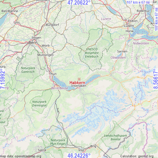
Habkern GPS coordinates[2]
46° 43' 35.004" North, 7° 51' 46.944" East
| Map corner | latitude | longitude |
|---|---|---|
| Upper-left | 47.20622°, | 7.15992° |
| Center: | 46.72639°, | 7.86304° |
| Lower-right: | 46.24226°, | 8.56617° |
| Map W x H: | 107.2×107.2 km | = 66.6×66.6mi |
| max Lat: | 47.76737° ⇑77.6% North |
| Habkern: | 46.72639° |
| min Lat: | ⇓22.4% South 45.83203° |
| min Long | Habkern | max Long |
| 5.97153° | 7.86304° | 10.44624° |
| W 36.4%⇐ | ⇒63.6% E |
Elevation
Elevation of Habkern is 1085 m = 3560 ft, and this is 526.8 m = 1728 ft above average elevation for this country.
| Max E: |
1845 m = 6053 ft | 3.7% |
| Habkern | 1085 m 3560 ft | |
| Avg. | 558.2 m = 1831 ft | |
Min E: |
197 m = 646 ft | 96.3% |
See also: Switzerland elevation on elevation.city.
Geographical zone
Habkern is located in North temperate zone (between Tropic of Cancer and the Arctic Circle). Distance of this North polar circle is 2205.7 km =1370.6 mi to North.| Distance of | km | miles | from Habkern |
|---|---|---|---|
| North Pole | 4811.6 | 2989.8 | to North |
| Arctic Circle | 2205.7 | 1370.6 | to North |
| Tropic Cancer | 2589.6 | 1609.1 | to South |
| Equator | 5195.5 | 3228.3 | to South |


Nearby cities:
15 places around Habkern: (largest is in red/bold)
• Beatenberg
6.1 km =3.8 mi,  239°
239°
• Brienz
13.7 km =8.5 mi,  76°
76°
• Bönigen
4.9 km =3 mi,  151°
151°
• Därligen
8.3 km =5.2 mi,  210°
210°
• Eriz
9.8 km =6.1 mi,  314°
314°
• Gsteig
6.9 km =4.3 mi,  173°
173°
• Interlaken
4.7 km =2.9 mi,  176°
176°
• Krattigen
12.6 km =7.8 mi,  234°
234°
• Leissigen
10.4 km =6.5 mi,  219°
219°
• Matten
5.4 km =3.4 mi, 175°
• Ringgenberg
3.7 km =2.3 mi,  139°
139°
• Schangnau
11.3 km =7 mi,  358°
358°
• Sigriswil
11.5 km =7.1 mi,  264°
264°
• Unterseen
4.7 km =2.9 mi,  194°
194°
• Wilderswil
7 km =4.3 mi, 180°
Sources, notices
• [Note1] Compared only with cities in Switzerland existing in our database
• [Src1] Map data: © OpenStreetMap contributors (CC-BY-SA)
• [Src2] Other city data from geonames.org with taken over terms of usage.
• [Src3] Geographical zone / Annual Mean Temperature by Robert A. Rohde @ Wikipedia
