Lauterbrunnen geodata
Lauterbrunnen (Bern) is a populated place; located in Switzerland in Europe/Zurich (GMT+2) time zone. With population of 2,646 people, there are 665 cities with bigger population in this country. Compared to other cities in Switzerland, 82.7% of cities are located further ↑North; 62.2% of cities are located further →East and 88.6% of cities have lower elevation than Lauterbrunnen. Note1
Administrative division(s):
- Level 1: Bern
- Level 2: Interlaken-Oberhasli District
- Level 3: Lauterbrunnen


Lauterbrunnen GPS coordinates[2]
46° 35' 35.052" North, 7° 54' 33.768" East
| Map corner | latitude | longitude |
|---|---|---|
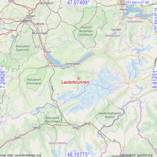
| Upper-left | 47.07409°, | 7.20626° |
| Center: | 46.59307°, | 7.90938° |
| Lower-right: | 46.10775°, | 8.61251° |
| Map W x H: | 107.4×107.4 km | = 66.7×66.7mi |
| max Lat: | 47.76737° ⇑82.7% North |
| Lauterbrunnen: | 46.59307° |
| min Lat: | ⇓17.3% South 45.83203° |
| min Long | Lauterbrunnen | max Long |
| 5.97153° | 7.90938° | 10.44624° |
| W 37.8%⇐ | ⇒62.2% E |
Elevation
Elevation of Lauterbrunnen is 787 m = 2582 ft, and this is 228.8 m = 751 ft above average elevation for this country.
| Max E: |
1845 m = 6053 ft | 11.4% |
| Lauterbrunnen | 787 m 2582 ft | |
| Avg. | 558.2 m = 1831 ft | |
Min E: |
197 m = 646 ft | 88.6% |
See also: Switzerland elevation on elevation.city.
Geographical zone
Lauterbrunnen is located in North temperate zone (between Tropic of Cancer and the Arctic Circle). Distance of this North polar circle is 2220.5 km =1379.8 mi to North.| Distance of | km | miles | from Lauterbrunnen |
|---|---|---|---|
| North Pole | 4826.4 | 2999 | to North |
| Arctic Circle | 2220.5 | 1379.8 | to North |
| Tropic Cancer | 2574.7 | 1599.8 | to South |
| Equator | 5180.7 | 3219.1 | to South |


Nearby cities:
15 places around Lauterbrunnen: (largest is in red/bold)
• Aeschi b. Spiez
17.8 km =11.1 mi,  294°
294°
• Beatenberg
14.7 km =9.1 mi,  323°
323°
• Bönigen
10.6 km =6.6 mi,  353°
353°
• Därligen
10.9 km =6.8 mi,  314°
314°
• Grindelwald
10.3 km =6.4 mi,  70°
70°
• Gsteig
8.5 km =5.3 mi,  340°
340°
• Habkern
15.2 km =9.4 mi, 346°
• Interlaken
10.6 km =6.6 mi, 341°
• Kandergrund
19.4 km =12.1 mi,  259°
259°
• Krattigen
15.8 km =9.8 mi,  298°
298°
• Leissigen
12.3 km =7.6 mi, 303°
• Matten
10 km =6.2 mi, 341°
• Ringgenberg
12.1 km =7.5 mi, 354°
• Unterseen
11.3 km =7 mi, 335°
• Wilderswil
8.7 km =5.4 mi, 335°
Sources, notices
• [Note1] Compared only with cities in Switzerland existing in our database
• [Src1] Map data: © OpenStreetMap contributors (CC-BY-SA)
• [Src2] Other city data from geonames.org with taken over terms of usage.
• [Src3] Geographical zone / Annual Mean Temperature by Robert A. Rohde @ Wikipedia
