Gempen geodata
Gempen (Solothurn) is a populated place; located in Switzerland in Europe/Zurich (GMT+2) time zone. With population of 722 people, there are 1569 cities with bigger population in this country. Compared to other cities in Switzerland, 85.6% of cities are located further ↓South; 69.6% of cities are located further →East and 81.3% of cities have lower elevation than Gempen. Note1


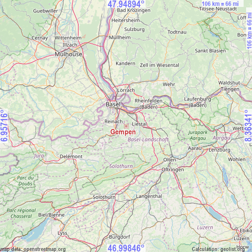
Gempen GPS coordinates[2]
47° 28' 33.06" North, 7° 39' 37.008" East
| Map corner | latitude | longitude |
|---|---|---|
| Upper-left | 47.94894°, | 6.95716° |
| Center: | 47.47585°, | 7.66028° |
| Lower-right: | 46.99846°, | 8.36341° |
| Map W x H: | 105.7×105.7 km | = 65.7×65.7mi |
| max Lat: | 47.76737° ⇑14.4% North |
| Gempen: | 47.47585° |
| min Lat: | ⇓85.6% South 45.83203° |
| min Long | Gempen | max Long |
| 5.97153° | 7.66028° | 10.44624° |
| W 30.4%⇐ | ⇒69.6% E |
Elevation
Elevation of Gempen is 679 m = 2228 ft, and this is 120.8 m = 396 ft above average elevation for this country.
| Max E: |
1845 m = 6053 ft | 18.7% |
| Gempen | 679 m 2228 ft | |
| Avg. | 558.2 m = 1831 ft | |
Min E: |
197 m = 646 ft | 81.3% |
See also: Switzerland elevation on elevation.city.
Geographical zone
Gempen is located in North temperate zone (between Tropic of Cancer and the Arctic Circle). Distance of this North polar circle is 2122.4 km =1318.8 mi to North.| Distance of | km | miles | from Gempen |
|---|---|---|---|
| North Pole | 4728.2 | 2938 | to North |
| Arctic Circle | 2122.4 | 1318.8 | to North |
| Tropic Cancer | 2672.9 | 1660.9 | to South |
| Equator | 5278.8 | 3280.1 | to South |


Nearby cities:
15 places around Gempen: (largest is in red/bold)
• Aesch
4.8 km =3 mi,  263°
263°
• Arlesheim
3.7 km =2.3 mi,  303°
303°
• Bubendorf
6.7 km =4.2 mi,  119°
119°
• Dornach
3.3 km =2.1 mi,  278°
278°
• Frenkendorf
5.5 km =3.4 mi,  50°
50°
• Füllinsdorf
6.4 km =4 mi,  57°
57°
• Grellingen
6.5 km =4 mi,  235°
235°
• Hochwald
2.7 km =1.7 mi,  205°
205°
• Lausen
7.5 km =4.7 mi,  93°
93°
• Liestal
5.7 km =3.5 mi,  80°
80°
• Muttenz
5.3 km =3.3 mi,  347°
347°
• Münchenstein
6.1 km =3.8 mi,  321°
321°
• Pfeffingen
5.6 km =3.5 mi,  251°
251°
• Pratteln
5.6 km =3.5 mi,  26°
26°
• Seltisberg
4.8 km =3 mi,  108°
108°
Sources, notices
• [Note1] Compared only with cities in Switzerland existing in our database
• [Src1] Map data: © OpenStreetMap contributors (CC-BY-SA)
• [Src2] Other city data from geonames.org with taken over terms of usage.
• [Src3] Geographical zone / Annual Mean Temperature by Robert A. Rohde @ Wikipedia
