Frauenkappelen geodata
Frauenkappelen (Bern) is a populated place; located in Switzerland in Europe/Zurich (GMT+2) time zone. With population of 1,281 people, there are 1146 cities with bigger population in this country. Compared to other cities in Switzerland, 66.7% of cities are located further ↑North; 79% of cities are located further →East and 73.6% of cities have lower elevation than Frauenkappelen. Note1


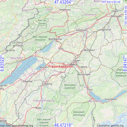
Frauenkappelen GPS coordinates[2]
46° 57' 15.3" North, 7° 20' 18.06" East
| Map corner | latitude | longitude |
|---|---|---|
| Upper-left | 47.43204°, | 6.63522° |
| Center: | 46.95425°, | 7.33835° |
| Lower-right: | 46.47216°, | 8.04147° |
| Map W x H: | 106.7×106.7 km | = 66.3×66.3mi |
| max Lat: | 47.76737° ⇑66.7% North |
| Frauenkappelen: | 46.95425° |
| min Lat: | ⇓33.3% South 45.83203° |
| min Long | Frauenkappelen | max Long |
| 5.97153° | 7.33835° | 10.44624° |
| W 21%⇐ | ⇒79% E |
Elevation
Elevation of Frauenkappelen is 602 m = 1975 ft, and this is 43.8 m = 144 ft above average elevation for this country.
| Max E: |
1845 m = 6053 ft | 26.4% |
| Frauenkappelen | 602 m 1975 ft | |
| Avg. | 558.2 m = 1831 ft | |
Min E: |
197 m = 646 ft | 73.6% |
See also: Switzerland elevation on elevation.city.
Geographical zone
Frauenkappelen is located in North temperate zone (between Tropic of Cancer and the Arctic Circle). Distance of this North polar circle is 2180.4 km =1354.8 mi to North.| Distance of | km | miles | from Frauenkappelen |
|---|---|---|---|
| North Pole | 4786.2 | 2974 | to North |
| Arctic Circle | 2180.4 | 1354.8 | to North |
| Tropic Cancer | 2614.9 | 1624.8 | to South |
| Equator | 5220.8 | 3244.1 | to South |


Nearby cities:
15 places around Frauenkappelen: (largest is in red/bold)
• Bern
8.3 km =5.2 mi,  94°
94°
• Ferenbalm
9.7 km =6 mi,  266°
266°
• Flamatt
7.3 km =4.5 mi,  189°
189°
• Kallnach
10.7 km =6.6 mi,  313°
313°
• Kirchlindach
7.8 km =4.8 mi,  49°
49°
• Köniz
6.7 km =4.2 mi,  119°
119°
• Laupen
9.5 km =5.9 mi,  232°
232°
• Mühleberg
5.9 km =3.7 mi, 270°
• Oberbalm
10.2 km =6.3 mi,  151°
151°
• Radelfingen
9 km =5.6 mi,  325°
325°
• Schüpfen
9.6 km =6 mi,  17°
17°
• Seedorf
9.1 km =5.7 mi,  347°
347°
• Ueberstorf
10.1 km =6.3 mi, 192°
• Wohlen
2.3 km =1.4 mi,  36°
36°
• Zollikofen
10.4 km =6.5 mi,  61°
61°
Sources, notices
• [Note1] Compared only with cities in Switzerland existing in our database
• [Src1] Map data: © OpenStreetMap contributors (CC-BY-SA)
• [Src2] Other city data from geonames.org with taken over terms of usage.
• [Src3] Geographical zone / Annual Mean Temperature by Robert A. Rohde @ Wikipedia
