Ueberstorf geodata
Ueberstorf (Fribourg) is a populated place; located in Switzerland in Europe/Zurich (GMT+2) time zone. With population of 2,133 people, there are 799 cities with bigger population in this country. Compared to other cities in Switzerland, 71.3% of cities are located further ↑North; 79.4% of cities are located further →East and 79.4% of cities have lower elevation than Ueberstorf. Note1


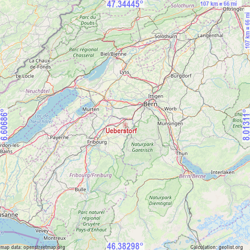
Ueberstorf GPS coordinates[2]
46° 51' 57.132" North, 7° 18' 35.928" East
| Map corner | latitude | longitude |
|---|---|---|
| Upper-left | 47.34445°, | 6.60686° |
| Center: | 46.86587°, | 7.30998° |
| Lower-right: | 46.38298°, | 8.01311° |
| Map W x H: | 106.9×106.9 km | = 66.4×66.4mi |
| max Lat: | 47.76737° ⇑71.3% North |
| Ueberstorf: | 46.86587° |
| min Lat: | ⇓28.7% South 45.83203° |
| min Long | Ueberstorf | max Long |
| 5.97153° | 7.30998° | 10.44624° |
| W 20.6%⇐ | ⇒79.4% E |
Elevation
Elevation of Ueberstorf is 655 m = 2149 ft, and this is 96.8 m = 318 ft above average elevation for this country.
| Max E: |
1845 m = 6053 ft | 20.6% |
| Ueberstorf | 655 m 2149 ft | |
| Avg. | 558.2 m = 1831 ft | |
Min E: |
197 m = 646 ft | 79.4% |
See also: Switzerland elevation on elevation.city.
Geographical zone
Ueberstorf is located in North temperate zone (between Tropic of Cancer and the Arctic Circle). Distance of this North polar circle is 2190.2 km =1360.9 mi to North.| Distance of | km | miles | from Ueberstorf |
|---|---|---|---|
| North Pole | 4796.1 | 2980.2 | to North |
| Arctic Circle | 2190.2 | 1360.9 | to North |
| Tropic Cancer | 2605.1 | 1618.7 | to South |
| Equator | 5211 | 3238 | to South |


Nearby cities:
15 places around Ueberstorf: (largest is in red/bold)
• Alterswil
8.7 km =5.4 mi,  206°
206°
• Bösingen
6.9 km =4.3 mi,  295°
295°
• Düdingen
9.2 km =5.7 mi,  258°
258°
• Flamatt
2.8 km =1.7 mi,  18°
18°
• Frauenkappelen
10.1 km =6.3 mi,  12°
12°
• Heitenried
4.3 km =2.7 mi,  190°
190°
• Kleinbösingen
8.5 km =5.3 mi,  291°
291°
• Köniz
10.3 km =6.4 mi,  50°
50°
• Laupen
6.7 km =4.2 mi,  307°
307°
• Liebistorf
9.9 km =6.2 mi, 298°
• Mühleberg
10.5 km =6.5 mi,  339°
339°
• Oberbalm
7.1 km =4.4 mi,  83°
83°
• Sankt Antoni
6.1 km =3.8 mi,  217°
217°
• Schmitten
4.6 km =2.9 mi, 258°
• Tafers
9 km =5.6 mi,  230°
230°
Sources, notices
• [Note1] Compared only with cities in Switzerland existing in our database
• [Src1] Map data: © OpenStreetMap contributors (CC-BY-SA)
• [Src2] Other city data from geonames.org with taken over terms of usage.
• [Src3] Geographical zone / Annual Mean Temperature by Robert A. Rohde @ Wikipedia
