Hagenbuch geodata
Hagenbuch (Zurich) is a populated place; located in Switzerland in Europe/Zurich (GMT+2) time zone. With population of 757 people, there are 1526 cities with bigger population in this country. Compared to other cities in Switzerland, 92.2% of cities are located further ↓South; 84.5% of cities are located further ←West and 62.7% of cities have lower elevation than Hagenbuch. Note1


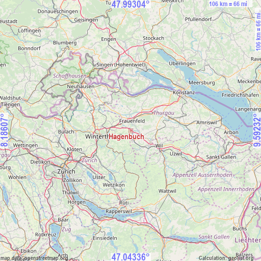
Hagenbuch GPS coordinates[2]
47° 31' 13.26" North, 8° 53' 21.12" East
| Map corner | latitude | longitude |
|---|---|---|
| Upper-left | 47.99304°, | 8.18607° |
| Center: | 47.52035°, | 8.8892° |
| Lower-right: | 47.04336°, | 9.59232° |
| Map W x H: | 105.6×105.6 km | = 65.6×65.6mi |
| max Lat: | 47.76737° ⇑7.8% North |
| Hagenbuch: | 47.52035° |
| min Lat: | ⇓92.2% South 45.83203° |
| min Long | Hagenbuch | max Long |
| 5.97153° | 8.8892° | 10.44624° |
| W 84.5%⇐ | ⇒15.5% E |
Elevation
Elevation of Hagenbuch is 534 m = 1752 ft, and this is 24.2 m = 79 ft below average elevation for this country.
| Max E: |
1845 m = 6053 ft | 37.3% |
| Avg. | 558.2 m = 1831 ft | |
| Hagenbuch | 534 m = 1752 ft | |
Min E: |
197 m = 646 ft | 62.7% |
See also: Switzerland elevation on elevation.city.
Geographical zone
Hagenbuch is located in North temperate zone (between Tropic of Cancer and the Arctic Circle). Distance of this North polar circle is 2117.4 km =1315.7 mi to North.| Distance of | km | miles | from Hagenbuch |
|---|---|---|---|
| North Pole | 4723.3 | 2934.9 | to North |
| Arctic Circle | 2117.4 | 1315.7 | to North |
| Tropic Cancer | 2677.8 | 1663.9 | to South |
| Equator | 5283.8 | 3283.2 | to South |


Nearby cities:
15 places around Hagenbuch: (largest is in red/bold)
• Aadorf
3.3 km =2.1 mi,  164°
164°
• Elgg
3.1 km =1.9 mi,  214°
214°
• Elgg / Neu-Elgg
2.8 km =1.7 mi,  222°
222°
• Elgg / Städtchen und Umgebung
3.5 km =2.2 mi, 208°
• Elsau-Räterschen
7.1 km =4.4 mi,  253°
253°
• Elsau-Räterschen / Räterschen
7.4 km =4.6 mi, 251°
• Frauenfeld
4.2 km =2.6 mi,  9°
9°
• Gachnang
3.4 km =2.1 mi,  307°
307°
• Matzingen
3.3 km =2.1 mi,  91°
91°
• Schottikon
6 km =3.7 mi, 246°
• Stettfurt
4.8 km =3 mi,  82°
82°
• Sulz
7.8 km =4.8 mi,  285°
285°
• Thundorf
6.3 km =3.9 mi,  62°
62°
• Wiesendangen / Wiesendangen (Dorf)
7.5 km =4.7 mi,  271°
271°
• Wängi
5.5 km =3.4 mi,  118°
118°
Sources, notices
• [Note1] Compared only with cities in Switzerland existing in our database
• [Src1] Map data: © OpenStreetMap contributors (CC-BY-SA)
• [Src2] Other city data from geonames.org with taken over terms of usage.
• [Src3] Geographical zone / Annual Mean Temperature by Robert A. Rohde @ Wikipedia
