Eggersriet geodata
Eggersriet (Saint Gallen) is a populated place; located in Switzerland in Europe/Zurich (GMT+2) time zone. With population of 2,209 people, there are 773 cities with bigger population in this country. Compared to other cities in Switzerland, 80.9% of cities are located further ↓South; 96.3% of cities are located further ←West and 89.9% of cities have lower elevation than Eggersriet. Note1


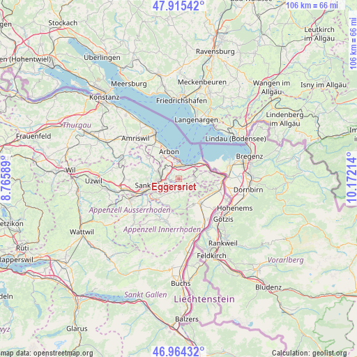
Eggersriet GPS coordinates[2]
47° 26' 31.272" North, 9° 28' 8.436" East
| Map corner | latitude | longitude |
|---|---|---|
| Upper-left | 47.91542°, | 8.76589° |
| Center: | 47.44202°, | 9.46901° |
| Lower-right: | 46.96432°, | 10.17214° |
| Map W x H: | 105.8×105.8 km | = 65.7×65.7mi |
| max Lat: | 47.76737° ⇑19.1% North |
| Eggersriet: | 47.44202° |
| min Lat: | ⇓80.9% South 45.83203° |
| min Long | Eggersriet | max Long |
| 5.97153° | 9.46901° | 10.44624° |
| W 96.3%⇐ | ⇒3.7% E |
Elevation
Elevation of Eggersriet is 817 m = 2680 ft, and this is 258.8 m = 849 ft above average elevation for this country.
| Max E: |
1845 m = 6053 ft | 10.1% |
| Eggersriet | 817 m 2680 ft | |
| Avg. | 558.2 m = 1831 ft | |
Min E: |
197 m = 646 ft | 89.9% |
See also: Switzerland elevation on elevation.city.
Geographical zone
Eggersriet is located in North temperate zone (between Tropic of Cancer and the Arctic Circle). Distance of this North polar circle is 2126.1 km =1321.1 mi to North.| Distance of | km | miles | from Eggersriet |
|---|---|---|---|
| North Pole | 4732 | 2940.3 | to North |
| Arctic Circle | 2126.1 | 1321.1 | to North |
| Tropic Cancer | 2669.1 | 1658.5 | to South |
| Equator | 5275.1 | 3277.8 | to South |


Nearby cities:
15 places around Eggersriet: (largest is in red/bold)
• Bühler
8.3 km =5.2 mi,  203°
203°
• Goldach
3.6 km =2.2 mi,  357°
357°
• Heiden
4.8 km =3 mi,  89°
89°
• Horn
5.8 km =3.6 mi, 355°
• Mörschwil
4.7 km =2.9 mi,  312°
312°
• Oberegg
6.5 km =4 mi,  106°
106°
• Rehetobel
2.1 km =1.3 mi,  149°
149°
• Roggwil
8.5 km =5.3 mi,  319°
319°
• Rorschach
4.3 km =2.7 mi,  21°
21°
• Sankt Gallen
7.4 km =4.6 mi,  254°
254°
• Speicher
4 km =2.5 mi,  209°
209°
• Teufen
8.4 km =5.2 mi,  227°
227°
• Thal
7.8 km =4.8 mi,  69°
69°
• Trogen
3.8 km =2.4 mi,  184°
184°
• Wittenbach
6.6 km =4.1 mi,  288°
288°
Sources, notices
• [Note1] Compared only with cities in Switzerland existing in our database
• [Src1] Map data: © OpenStreetMap contributors (CC-BY-SA)
• [Src2] Other city data from geonames.org with taken over terms of usage.
• [Src3] Geographical zone / Annual Mean Temperature by Robert A. Rohde @ Wikipedia
