Oberegg geodata
Oberegg (Appenzell Innerrhoden) is a populated place; located in Switzerland in Europe/Zurich (GMT+2) time zone. With population of 1,827 people, there are 899 cities with bigger population in this country. Compared to other cities in Switzerland, 78.9% of cities are located further ↓South; 97.5% of cities are located further ←West and 91.8% of cities have lower elevation than Oberegg. Note1
Administrative division(s):
- Level 1: Appenzell Innerrhoden
- Level 2: Appenzell Inner Rhodes
- Level 3: Oberegg


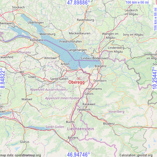
Oberegg GPS coordinates[2]
47° 25' 31.116" North, 9° 33' 4.824" East
| Map corner | latitude | longitude |
|---|---|---|
| Upper-left | 47.89886°, | 8.84822° |
| Center: | 47.42531°, | 9.55134° |
| Lower-right: | 46.94746°, | 10.25447° |
| Map W x H: | 105.8×105.8 km | = 65.7×65.7mi |
| max Lat: | 47.76737° ⇑21.1% North |
| Oberegg: | 47.42531° |
| min Lat: | ⇓78.9% South 45.83203° |
| min Long | Oberegg | max Long |
| 5.97153° | 9.55134° | 10.44624° |
| W 97.5%⇐ | ⇒2.5% E |
Elevation
Elevation of Oberegg is 875 m = 2871 ft, and this is 316.8 m = 1039 ft above average elevation for this country.
| Max E: |
1845 m = 6053 ft | 8.2% |
| Oberegg | 875 m 2871 ft | |
| Avg. | 558.2 m = 1831 ft | |
Min E: |
197 m = 646 ft | 91.8% |
See also: Switzerland elevation on elevation.city.
Geographical zone
Oberegg is located in North temperate zone (between Tropic of Cancer and the Arctic Circle). Distance of this North polar circle is 2128 km =1322.3 mi to North.| Distance of | km | miles | from Oberegg |
|---|---|---|---|
| North Pole | 4733.9 | 2941.5 | to North |
| Arctic Circle | 2128 | 1322.3 | to North |
| Tropic Cancer | 2667.3 | 1657.4 | to South |
| Equator | 5273.2 | 3276.6 | to South |


Nearby cities:
15 places around Oberegg: (largest is in red/bold)
• Altstätten
5.3 km =3.3 mi,  183°
183°
• Au
6.3 km =3.9 mi,  84°
84°
• Balgach
4.7 km =2.9 mi,  117°
117°
• Eggersriet
6.5 km =4 mi,  286°
286°
• Goldach
8.3 km =5.2 mi,  310°
310°
• Heiden
2.4 km =1.5 mi,  324°
324°
• Rebstein
3.9 km =2.4 mi,  140°
140°
• Rehetobel
5.1 km =3.2 mi,  270°
270°
• Rheineck
5.4 km =3.4 mi,  32°
32°
• Rorschach
7.4 km =4.6 mi, 321°
• Sankt Margrethen
7.1 km =4.4 mi,  64°
64°
• Speicher
8.3 km =5.2 mi,  258°
258°
• Thal
4.7 km =2.9 mi,  13°
13°
• Trogen
6.8 km =4.2 mi,  253°
253°
• Walzenhausen
4.8 km =3 mi, 57°
Sources, notices
• [Note1] Compared only with cities in Switzerland existing in our database
• [Src1] Map data: © OpenStreetMap contributors (CC-BY-SA)
• [Src2] Other city data from geonames.org with taken over terms of usage.
• [Src3] Geographical zone / Annual Mean Temperature by Robert A. Rohde @ Wikipedia
