Teufen geodata
Teufen (Appenzell Ausserrhoden) is a populated place; located in Switzerland in Europe/Zurich (GMT+2) time zone. With population of 5,683 people, there are 292 cities with bigger population in this country. Compared to other cities in Switzerland, 71.3% of cities are located further ↓South; 95% of cities are located further ←West and 90.8% of cities have lower elevation than Teufen. Note1
Administrative division(s):
- Level 1: Appenzell Ausserrhoden
- Level 2: Bezirk Mittelland
- Level 3: Teufen (AR)


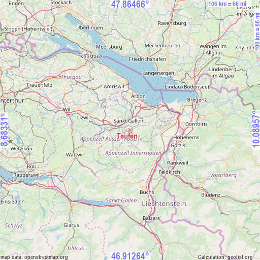
Teufen GPS coordinates[2]
47° 23' 26.88" North, 9° 23' 11.184" East
| Map corner | latitude | longitude |
|---|---|---|
| Upper-left | 47.86466°, | 8.68331° |
| Center: | 47.3908°, | 9.38644° |
| Lower-right: | 46.91264°, | 10.08957° |
| Map W x H: | 105.9×105.9 km | = 65.8×65.8mi |
| max Lat: | 47.76737° ⇑28.7% North |
| Teufen: | 47.3908° |
| min Lat: | ⇓71.3% South 45.83203° |
| min Long | Teufen | max Long |
| 5.97153° | 9.38644° | 10.44624° |
| W 95%⇐ | ⇒5% E |
Elevation
Elevation of Teufen is 842 m = 2762 ft, and this is 283.8 m = 931 ft above average elevation for this country.
| Max E: |
1845 m = 6053 ft | 9.2% |
| Teufen | 842 m 2762 ft | |
| Avg. | 558.2 m = 1831 ft | |
Min E: |
197 m = 646 ft | 90.8% |
See also: Switzerland elevation on elevation.city.
Geographical zone
Teufen is located in North temperate zone (between Tropic of Cancer and the Arctic Circle). Distance of this North polar circle is 2131.8 km =1324.6 mi to North.| Distance of | km | miles | from Teufen |
|---|---|---|---|
| North Pole | 4737.7 | 2943.9 | to North |
| Arctic Circle | 2131.8 | 1324.6 | to North |
| Tropic Cancer | 2663.4 | 1655 | to South |
| Equator | 5269.4 | 3274.3 | to South |


Nearby cities:
15 places around Teufen: (largest is in red/bold)
• Abtwil
6.1 km =3.8 mi,  306°
306°
• Appenzell
6.9 km =4.3 mi,  165°
165°
• Bühler
3.5 km =2.2 mi,  123°
123°
• Eggersriet
8.4 km =5.2 mi,  47°
47°
• Gais
6 km =3.7 mi, 122°
• Gonten
7.7 km =4.8 mi,  202°
202°
• Haslen
2.8 km =1.7 mi,  210°
210°
• Herisau
8.1 km =5 mi,  266°
266°
• Hundwil
5.9 km =3.7 mi,  240°
240°
• Rehetobel
8.3 km =5.2 mi,  61°
61°
• Sankt Gallen
3.8 km =2.4 mi,  346°
346°
• Speicher
4.8 km =3 mi, 62°
• Trogen
6.2 km =3.9 mi,  72°
72°
• Waldstatt
8.7 km =5.4 mi, 243°
• Wittenbach
7.8 km =4.8 mi,  359°
359°
Sources, notices
• [Note1] Compared only with cities in Switzerland existing in our database
• [Src1] Map data: © OpenStreetMap contributors (CC-BY-SA)
• [Src2] Other city data from geonames.org with taken over terms of usage.
• [Src3] Geographical zone / Annual Mean Temperature by Robert A. Rohde @ Wikipedia
