Densbüren geodata
Densbüren (Aargau) is a seat of a third-order administrative division; located in Switzerland in Europe/Zurich (GMT+2) time zone. With population of 758 people, there are 1525 cities with bigger population in this country. Compared to other cities in Switzerland, 82.9% of cities are located further ↓South; 58.9% of cities are located further →East and 52.6% of cities have lower elevation than Densbüren. Note1


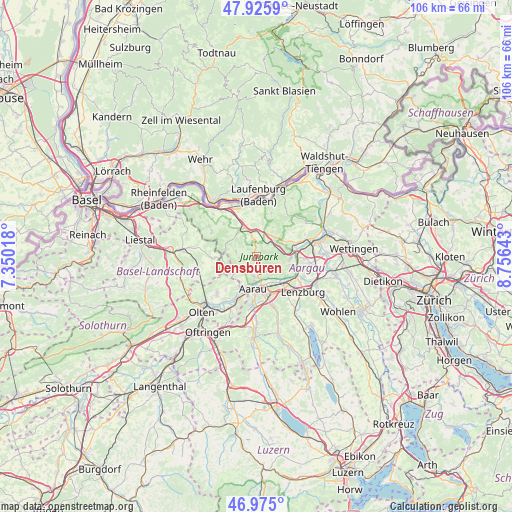
Densbüren GPS coordinates[2]
47° 27' 9.36" North, 8° 3' 11.88" East
| Map corner | latitude | longitude |
|---|---|---|
| Upper-left | 47.9259°, | 7.35018° |
| Center: | 47.4526°, | 8.0533° |
| Lower-right: | 46.975°, | 8.75643° |
| Map W x H: | 105.7×105.7 km | = 65.7×65.7mi |
| max Lat: | 47.76737° ⇑17.1% North |
| Densbüren: | 47.4526° |
| min Lat: | ⇓82.9% South 45.83203° |
| min Long | Densbüren | max Long |
| 5.97153° | 8.0533° | 10.44624° |
| W 41.1%⇐ | ⇒58.9% E |
Elevation
Elevation of Densbüren is 486 m = 1594 ft, and this is 72.2 m = 237 ft below average elevation for this country.
| Max E: |
1845 m = 6053 ft | 47.4% |
| Avg. | 558.2 m = 1831 ft | |
| Densbüren | 486 m = 1594 ft | |
Min E: |
197 m = 646 ft | 52.6% |
See also: Switzerland elevation on elevation.city.
Geographical zone
Densbüren is located in North temperate zone (between Tropic of Cancer and the Arctic Circle). Distance of this North polar circle is 2124.9 km =1320.4 mi to North.| Distance of | km | miles | from Densbüren |
|---|---|---|---|
| North Pole | 4730.8 | 2939.6 | to North |
| Arctic Circle | 2124.9 | 1320.4 | to North |
| Tropic Cancer | 2670.3 | 1659.2 | to South |
| Equator | 5276.2 | 3278.5 | to South |


Nearby cities:
15 places around Densbüren: (largest is in red/bold)
• Aarau
6.7 km =4.2 mi,  185°
185°
• Biberstein
4.7 km =2.9 mi,  149°
149°
• Buchs
6.9 km =4.3 mi,  161°
161°
• Bözen
5.3 km =3.3 mi,  26°
26°
• Effingen
5.5 km =3.4 mi,  42°
42°
• Frick
6.9 km =4.3 mi,  341°
341°
• Gipf-Oberfrick
6.3 km =3.9 mi,  324°
324°
• Hornussen
5.3 km =3.3 mi,  7°
7°
• Küttigen
4.2 km =2.6 mi,  183°
183°
• Oberhof
3.8 km =2.4 mi,  263°
263°
• Schinznach Dorf
6.6 km =4.1 mi,  95°
95°
• Thalheim
4 km =2.5 mi,  118°
118°
• Wittnau
6.6 km =4.1 mi,  298°
298°
• Wölflinswil
4.2 km =2.6 mi,  282°
282°
• Zeihen
3.6 km =2.2 mi, 42°
Sources, notices
• [Note1] Compared only with cities in Switzerland existing in our database
• [Src1] Map data: © OpenStreetMap contributors (CC-BY-SA)
• [Src2] Other city data from geonames.org with taken over terms of usage.
• [Src3] Geographical zone / Annual Mean Temperature by Robert A. Rohde @ Wikipedia
