Attalens geodata
Attalens (Fribourg) is a populated place; located in Switzerland in Europe/Zurich (GMT+2) time zone. With population of 2,380 people, there are 720 cities with bigger population in this country. Compared to other cities in Switzerland, 85.4% of cities are located further ↑North; 90.6% of cities are located further →East and 87.2% of cities have lower elevation than Attalens. Note1


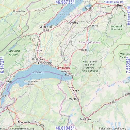
Attalens GPS coordinates[2]
46° 30' 19.98" North, 6° 51' 1.404" East
| Map corner | latitude | longitude |
|---|---|---|
| Upper-left | 46.98735°, | 6.14727° |
| Center: | 46.50555°, | 6.85039° |
| Lower-right: | 46.01945°, | 7.55352° |
| Map W x H: | 107.6×107.6 km | = 66.9×66.9mi |
| max Lat: | 47.76737° ⇑85.4% North |
| Attalens: | 46.50555° |
| min Lat: | ⇓14.6% South 45.83203° |
| min Long | Attalens | max Long |
| 5.97153° | 6.85039° | 10.44624° |
| W 9.4%⇐ | ⇒90.6% E |
Elevation
Elevation of Attalens is 766 m = 2513 ft, and this is 207.8 m = 682 ft above average elevation for this country.
| Max E: |
1845 m = 6053 ft | 12.8% |
| Attalens | 766 m 2513 ft | |
| Avg. | 558.2 m = 1831 ft | |
Min E: |
197 m = 646 ft | 87.2% |
See also: Switzerland elevation on elevation.city.
Geographical zone
Attalens is located in North temperate zone (between Tropic of Cancer and the Arctic Circle). Distance of this North polar circle is 2230.2 km =1385.8 mi to North.| Distance of | km | miles | from Attalens |
|---|---|---|---|
| North Pole | 4836.1 | 3005 | to North |
| Arctic Circle | 2230.2 | 1385.8 | to North |
| Tropic Cancer | 2565 | 1593.8 | to South |
| Equator | 5170.9 | 3213 | to South |


Nearby cities:
15 places around Attalens: (largest is in red/bold)
• Blonay
5.5 km =3.4 mi,  140°
140°
• Chardonne
3.7 km =2.3 mi,  209°
209°
• Chexbres
6.1 km =3.8 mi,  244°
244°
• Châtel-Saint-Denis
4.5 km =2.8 mi,  58°
58°
• Jongny
3.1 km =1.9 mi,  193°
193°
• La Tour-de-Peilz
5.9 km =3.7 mi,  173°
173°
• Maracon
5.2 km =3.2 mi,  18°
18°
• Montreux
9.3 km =5.8 mi,  149°
149°
• Oron-la-Ville
7.5 km =4.7 mi,  345°
345°
• Palézieux
4.1 km =2.5 mi, 348°
• Puidoux
5.2 km =3.2 mi,  264°
264°
• Saint Saphorin
5.5 km =3.4 mi,  229°
229°
• Servion
9.1 km =5.7 mi,  322°
322°
• St-Légier-La Chiésaz
4.1 km =2.5 mi, 154°
• Vevey
4.8 km =3 mi, 186°
Sources, notices
• [Note1] Compared only with cities in Switzerland existing in our database
• [Src1] Map data: © OpenStreetMap contributors (CC-BY-SA)
• [Src2] Other city data from geonames.org with taken over terms of usage.
• [Src3] Geographical zone / Annual Mean Temperature by Robert A. Rohde @ Wikipedia
