Bonaduz geodata
Bonaduz (Grisons) is a populated place; located in Switzerland in Europe/Zurich (GMT+2) time zone. With population of 2,654 people, there are 664 cities with bigger population in this country. Compared to other cities in Switzerland, 74% of cities are located further ↑North; 95.2% of cities are located further ←West and 79.8% of cities have lower elevation than Bonaduz. Note1


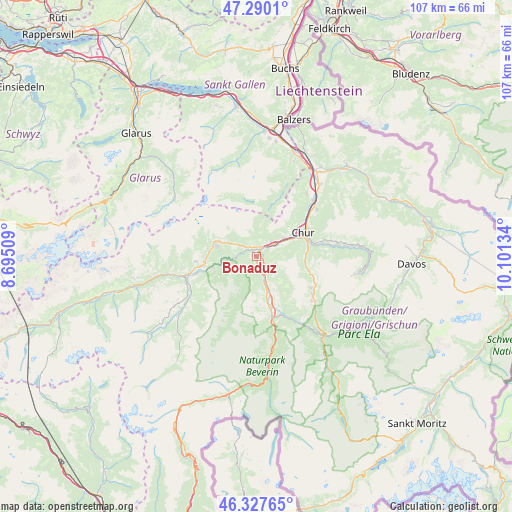
Bonaduz GPS coordinates[2]
46° 48' 39.708" North, 9° 23' 53.556" East
| Map corner | latitude | longitude |
|---|---|---|
| Upper-left | 47.2901°, | 8.69509° |
| Center: | 46.81103°, | 9.39821° |
| Lower-right: | 46.32765°, | 10.10134° |
| Map W x H: | 107×107 km | = 66.5×66.5mi |
| max Lat: | 47.76737° ⇑74% North |
| Bonaduz: | 46.81103° |
| min Lat: | ⇓26% South 45.83203° |
| min Long | Bonaduz | max Long |
| 5.97153° | 9.39821° | 10.44624° |
| W 95.2%⇐ | ⇒4.8% E |
Elevation
Elevation of Bonaduz is 658 m = 2159 ft, and this is 99.8 m = 327 ft above average elevation for this country.
| Max E: |
1845 m = 6053 ft | 20.2% |
| Bonaduz | 658 m 2159 ft | |
| Avg. | 558.2 m = 1831 ft | |
Min E: |
197 m = 646 ft | 79.8% |
See also: Switzerland elevation on elevation.city.
Geographical zone
Bonaduz is located in North temperate zone (between Tropic of Cancer and the Arctic Circle). Distance of this North polar circle is 2196.3 km =1364.7 mi to North.| Distance of | km | miles | from Bonaduz |
|---|---|---|---|
| North Pole | 4802.2 | 2983.9 | to North |
| Arctic Circle | 2196.3 | 1364.7 | to North |
| Tropic Cancer | 2599 | 1614.9 | to South |
| Equator | 5204.9 | 3234.2 | to South |


Nearby cities:
15 places around Bonaduz: (largest is in red/bold)
• Cazis
10.5 km =6.5 mi,  165°
165°
• Chur
11.1 km =6.9 mi,  67°
67°
• Churwalden
11.6 km =7.2 mi,  106°
106°
• Domat
4.8 km =3 mi,  56°
56°
• Falera
12.8 km =8 mi,  265°
265°
• Felsberg
7.1 km =4.4 mi, 56°
• Flims
9.1 km =5.7 mi,  288°
288°
• Haldenstein
12.3 km =7.6 mi,  52°
52°
• Laax
10.7 km =6.6 mi, 266°
• Malix
10.2 km =6.3 mi,  89°
89°
• Rhäzüns
1.3 km =0.8 mi,  181°
181°
• Scharans
11.3 km =7 mi,  155°
155°
• Sils im Domleschg
13 km =8.1 mi, 160°
• Tamins
2.2 km =1.4 mi,  16°
16°
• Thusis
13 km =8.1 mi, 166°
Sources, notices
• [Note1] Compared only with cities in Switzerland existing in our database
• [Src1] Map data: © OpenStreetMap contributors (CC-BY-SA)
• [Src2] Other city data from geonames.org with taken over terms of usage.
• [Src3] Geographical zone / Annual Mean Temperature by Robert A. Rohde @ Wikipedia
