Domat geodata
Domat (Grisons) is a seat of a second-order administrative division; located in Switzerland in Europe/Zurich (GMT+2) time zone. With population of 6,817 people, there are 236 cities with bigger population in this country. Compared to other cities in Switzerland, 72.4% of cities are located further ↑North; 95.9% of cities are located further ←West and 71.8% of cities have lower elevation than Domat. Note1


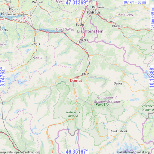
Domat GPS coordinates[2]
46° 50' 5.388" North, 9° 27' 2.7" East
| Map corner | latitude | longitude |
|---|---|---|
| Upper-left | 47.31369°, | 8.74762° |
| Center: | 46.83483°, | 9.45075° |
| Lower-right: | 46.35167°, | 10.15388° |
| Map W x H: | 107×107 km | = 66.5×66.5mi |
| max Lat: | 47.76737° ⇑72.4% North |
| Domat: | 46.83483° |
| min Lat: | ⇓27.6% South 45.83203° |
| min Long | Domat | max Long |
| 5.97153° | 9.45075° | 10.44624° |
| W 95.9%⇐ | ⇒4.1% E |
Elevation
Elevation of Domat is 585 m = 1919 ft, and this is 26.8 m = 88 ft above average elevation for this country.
| Max E: |
1845 m = 6053 ft | 28.2% |
| Domat | 585 m 1919 ft | |
| Avg. | 558.2 m = 1831 ft | |
Min E: |
197 m = 646 ft | 71.8% |
See also: Switzerland elevation on elevation.city.
Geographical zone
Domat is located in North temperate zone (between Tropic of Cancer and the Arctic Circle). Distance of this North polar circle is 2193.6 km =1363 mi to North.| Distance of | km | miles | from Domat |
|---|---|---|---|
| North Pole | 4799.5 | 2982.3 | to North |
| Arctic Circle | 2193.6 | 1363 | to North |
| Tropic Cancer | 2601.6 | 1616.6 | to South |
| Equator | 5207.5 | 3235.8 | to South |


Nearby cities:
15 places around Domat: (largest is in red/bold)
• Bonaduz
4.8 km =3 mi,  236°
236°
• Cazis
12.9 km =8 mi,  186°
186°
• Chur
6.5 km =4 mi,  75°
75°
• Churwalden
9.2 km =5.7 mi,  129°
129°
• Felsberg
2.3 km =1.4 mi,  57°
57°
• Flims
12.6 km =7.8 mi,  271°
271°
• Haldenstein
7.5 km =4.7 mi,  49°
49°
• Malix
6.7 km =4.2 mi,  111°
111°
• Rhäzüns
5.7 km =3.5 mi,  225°
225°
• Scharans
13 km =8.1 mi,  177°
177°
• Sils im Domleschg
14.9 km =9.3 mi, 179°
• Tamins
3.4 km =2.1 mi,  260°
260°
• Trimmis
11.1 km =6.9 mi, 48°
• Untervaz
12.1 km =7.5 mi,  31°
31°
• Zizers
14.2 km =8.8 mi,  37°
37°
Sources, notices
• [Note1] Compared only with cities in Switzerland existing in our database
• [Src1] Map data: © OpenStreetMap contributors (CC-BY-SA)
• [Src2] Other city data from geonames.org with taken over terms of usage.
• [Src3] Geographical zone / Annual Mean Temperature by Robert A. Rohde @ Wikipedia
