Hedingen geodata
Hedingen (Zurich) is a populated place; located in Switzerland in Europe/Zurich (GMT+2) time zone. With population of 2,835 people, there are 619 cities with bigger population in this country. Compared to other cities in Switzerland, 57.7% of cities are located further ↓South; 53.1% of cities are located further ←West and 56.9% of cities have lower elevation than Hedingen. Note1


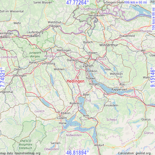
Hedingen GPS coordinates[2]
47° 17' 52.584" North, 8° 26' 53.988" East
| Map corner | latitude | longitude |
|---|---|---|
| Upper-left | 47.77264°, | 7.74521° |
| Center: | 47.29794°, | 8.44833° |
| Lower-right: | 46.81894°, | 9.15146° |
| Map W x H: | 106×106 km | = 65.9×65.9mi |
| max Lat: | 47.76737° ⇑42.3% North |
| Hedingen: | 47.29794° |
| min Lat: | ⇓57.7% South 45.83203° |
| min Long | Hedingen | max Long |
| 5.97153° | 8.44833° | 10.44624° |
| W 53.1%⇐ | ⇒46.9% E |
Elevation
Elevation of Hedingen is 504 m = 1654 ft, and this is 54.2 m = 178 ft below average elevation for this country.
| Max E: |
1845 m = 6053 ft | 43.1% |
| Avg. | 558.2 m = 1831 ft | |
| Hedingen | 504 m = 1654 ft | |
Min E: |
197 m = 646 ft | 56.9% |
See also: Switzerland elevation on elevation.city.
Geographical zone
Hedingen is located in North temperate zone (between Tropic of Cancer and the Arctic Circle). Distance of this North polar circle is 2142.1 km =1331 mi to North.| Distance of | km | miles | from Hedingen |
|---|---|---|---|
| North Pole | 4748 | 2950.3 | to North |
| Arctic Circle | 2142.1 | 1331 | to North |
| Tropic Cancer | 2653.1 | 1648.6 | to South |
| Equator | 5259 | 3267.8 | to South |


Nearby cities:
15 places around Hedingen: (largest is in red/bold)
• Aeugst / Aeugst (Dorf)
4.2 km =2.6 mi,  138°
138°
• Affoltern / Butzen
2.5 km =1.6 mi,  163°
163°
• Affoltern / Goldiger Berg
2.2 km =1.4 mi,  186°
186°
• Affoltern / Hasenbüel
2.8 km =1.7 mi,  173°
173°
• Affoltern / Oberdorf
2.2 km =1.4 mi, 164°
• Affoltern / Sonnenberg
2.1 km =1.3 mi, 155°
• Affoltern / Unterdorf
1.7 km =1.1 mi, 165°
• Affoltern am Albis
2.3 km =1.4 mi, 174°
• Bonstetten
2.4 km =1.5 mi,  38°
38°
• Jonen
4.2 km =2.6 mi,  269°
269°
• Obfelden / Bickwil
3.6 km =2.2 mi,  209°
209°
• Obfelden / Toussen
3.8 km =2.4 mi,  200°
200°
• Ottenbach
3.7 km =2.3 mi,  242°
242°
• Schachen
3.4 km =2.1 mi,  31°
31°
• Zwillikon
1.7 km =1.1 mi,  230°
230°
Sources, notices
• [Note1] Compared only with cities in Switzerland existing in our database
• [Src1] Map data: © OpenStreetMap contributors (CC-BY-SA)
• [Src2] Other city data from geonames.org with taken over terms of usage.
• [Src3] Geographical zone / Annual Mean Temperature by Robert A. Rohde @ Wikipedia
