Buchs / Buchs (Nord) geodata
Buchs / Buchs (Nord) (Zurich) is a section of populated place; located in Switzerland in Europe/Zurich (GMT+2) time zone. With population of 512 people, there are 1788 cities with bigger population in this country. Compared to other cities in Switzerland, 83.8% of cities are located further ↓South; 52.1% of cities are located further ←West and 53.2% of cities have lower elevation than Buchs / Buchs (Nord). Note1


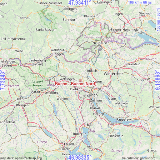
Buchs / Buchs (Nord) GPS coordinates[2]
47° 27' 39.168" North, 8° 26' 7.98" East
| Map corner | latitude | longitude |
|---|---|---|
| Upper-left | 47.93411°, | 7.73243° |
| Center: | 47.46088°, | 8.43555° |
| Lower-right: | 46.98335°, | 9.13868° |
| Map W x H: | 105.7×105.7 km | = 65.7×65.7mi |
| max Lat: | 47.76737° ⇑16.2% North |
| Buchs / Buchs (Nord): | 47.46088° |
| min Lat: | ⇓83.8% South 45.83203° |
| min Long | Buchs / Buchs ( | max Long |
| 5.97153° | 8.43555° | 10.44624° |
| W 52.1%⇐ | ⇒47.9% E |
Elevation
Elevation of Buchs / Buchs (Nord) is 488 m = 1601 ft, and this is 70.2 m = 230 ft below average elevation for this country.
| Max E: |
1845 m = 6053 ft | 46.8% |
| Avg. | 558.2 m = 1831 ft | |
| Buchs / Buchs (Nord) | 488 m = 1601 ft | |
Min E: |
197 m = 646 ft | 53.2% |
See also: Switzerland elevation on elevation.city.
Geographical zone
Buchs / Buchs (Nord) is located in North temperate zone (between Tropic of Cancer and the Arctic Circle). Distance of this North polar circle is 2124 km =1319.8 mi to North.| Distance of | km | miles | from Buchs / Buchs (Nord) |
|---|---|---|---|
| North Pole | 4729.9 | 2939 | to North |
| Arctic Circle | 2124 | 1319.8 | to North |
| Tropic Cancer | 2671.2 | 1659.8 | to South |
| Equator | 5277.2 | 3279.1 | to South |


Nearby cities:
15 places around Buchs / Buchs (Nord): (largest is in red/bold)
• Adlikon
2.8 km =1.7 mi,  123°
123°
• Boppelsen
2.4 km =1.5 mi,  293°
293°
• Buchs / Ringstrasse
0.7 km =0.4 mi,  153°
153°
• Buchs / Zürcherstrasse
0.6 km =0.4 mi,  131°
131°
• Dielsdorf
2.9 km =1.8 mi,  37°
37°
• Dällikon / Dällikon (Dorf)
2.3 km =1.4 mi,  175°
175°
• Dällikon / Sytenacher
2.6 km =1.6 mi,  164°
164°
• Dänikon
2.7 km =1.7 mi,  234°
234°
• Dänikon / Bifang
2.5 km =1.6 mi, 233°
• Laubisser
3.4 km =2.1 mi,  114°
114°
• Otelfingen
3.3 km =2.1 mi,  269°
269°
• Rain
2.7 km =1.7 mi, 225°
• Regensdorf / Hofacher-Geeren
3.5 km =2.2 mi,  144°
144°
• Schibler
3.2 km =2 mi,  20°
20°
• Sonnhalde
2.1 km =1.3 mi, 113°
Sources, notices
• [Note1] Compared only with cities in Switzerland existing in our database
• [Src1] Map data: © OpenStreetMap contributors (CC-BY-SA)
• [Src2] Other city data from geonames.org with taken over terms of usage.
• [Src3] Geographical zone / Annual Mean Temperature by Robert A. Rohde @ Wikipedia
