Horgen / Horgen (Dorfkern) geodata
Horgen / Horgen (Dorfkern) (Zurich) is a section of populated place; located in Switzerland in Europe/Zurich (GMT+2) time zone. With population of 6,140 people, there are 271 cities with bigger population in this country. Compared to other cities in Switzerland, 52.4% of cities are located further ↓South; 66.6% of cities are located further ←West and 63.1% of cities have higher elevation than Horgen / Horgen (Dorfkern). Note1
Current local time in Horgen / Horgen (Dorfkern):
07:35 AM, SaturdayDifference from your time zone: hours


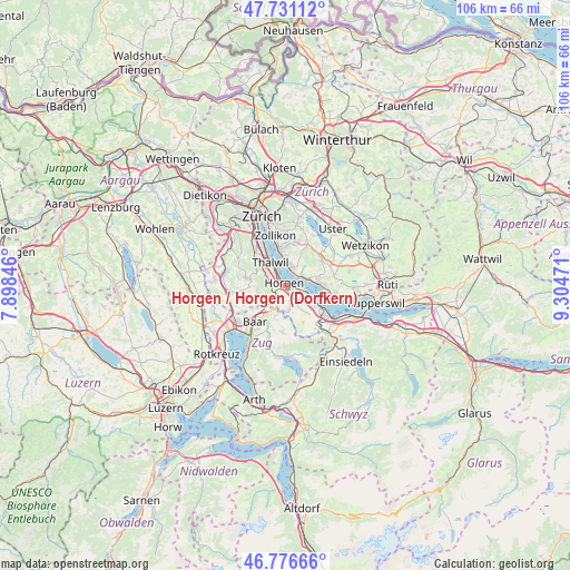
Horgen / Horgen (Dorfkern) GPS coordinates[2]
47° 15' 21.744" North, 8° 36' 5.724" East
| Map corner | latitude | longitude |
|---|---|---|
| Upper-left | 47.73112°, | 7.89846° |
| Center: | 47.25604°, | 8.60159° |
| Lower-right: | 46.77666°, | 9.30471° |
| Map W x H: | 106.1×106.1 km | = 65.9×65.9mi |
| max Lat: | 47.76737° ⇑47.6% North |
| Horgen / Horgen (Dorfkern): | 47.25604° |
| min Lat: | ⇓52.4% South 45.83203° |
| min Long | Horgen / Horgen | max Long |
| 5.97153° | 8.60159° | 10.44624° |
| W 66.6%⇐ | ⇒33.4% E |
Elevation
Elevation of Horgen / Horgen (Dorfkern) is 449 m = 1473 ft, and this is 109.2 m = 358 ft below average elevation for this country.
| Max E: |
1845 m = 6053 ft | 63.1% |
| Avg. | 558.2 m = 1831 ft | |
| Horgen / Horgen (Dorfkern) | 449 m = 1473 ft | |
Min E: |
197 m = 646 ft | 36.9% |
See also: Switzerland elevation on elevation.city.
Geographical zone
Horgen / Horgen (Dorfkern) is located in North temperate zone (between Tropic of Cancer and the Arctic Circle). Distance of this North polar circle is 2146.8 km =1334 mi to North.| Distance of | km | miles | from Horgen / Horgen (Dorfkern) |
|---|---|---|---|
| North Pole | 4752.7 | 2953.2 | to North |
| Arctic Circle | 2146.8 | 1334 | to North |
| Tropic Cancer | 2648.5 | 1645.7 | to South |
| Equator | 5254.4 | 3264.9 | to South |


Nearby cities:
15 places around Horgen / Horgen (Dorfkern): (largest is in red/bold)
• Au
3.6 km =2.2 mi,  116°
116°
• Au / Mittel-Dorf
3.6 km =2.2 mi,  113°
113°
• Au / Unter-Dorf
2.5 km =1.6 mi, 112°
• Feldmeilen
2.9 km =1.8 mi,  30°
30°
• Herrliberg
4 km =2.5 mi,  14°
14°
• Horgen
0.5 km =0.3 mi,  325°
325°
• Horgen / Allmend
1 km =0.6 mi,  158°
158°
• Horgen / Käpfnach
0.9 km =0.6 mi,  101°
101°
• Horgen / Oberdorf
0.9 km =0.6 mi,  286°
286°
• Horgen / Scheller-Stockerstrasse
1.5 km =0.9 mi,  315°
315°
• Meilen
3.8 km =2.4 mi,  61°
61°
• Oberrieden
2.7 km =1.7 mi, 319°
• Oberrieden / Berg
3.1 km =1.9 mi, 315°
• Oberrieden / Mitte
2.4 km =1.5 mi, 318°
• Oberrieden / See
2.5 km =1.6 mi, 324°
Sources, notices
• [Note1] Compared only with cities in Switzerland existing in our database
• [Src1] Map data: © OpenStreetMap contributors (CC-BY-SA)
• [Src2] Other city data from geonames.org with taken over terms of usage.
• [Src3] Geographical zone / Annual Mean Temperature by Robert A. Rohde @ Wikipedia
