Horgen / Scheller-Stockerstrasse geodata
Horgen / Scheller-Stockerstrasse (Zurich) is a section of populated place; located in Switzerland in Europe/Zurich (GMT+2) time zone. With population of 2,690 people, there are 658 cities with bigger population in this country. Compared to other cities in Switzerland, 53.7% of cities are located further ↓South; 65.1% of cities are located further ←West and 79.7% of cities have higher elevation than Horgen / Scheller-Stockerstrasse. Note1
Current local time in Horgen / Scheller-Stockerstrasse:
08:54 AM, SaturdayDifference from your time zone: hours


Horgen / Scheller-Stockerstrasse GPS coordinates[2]
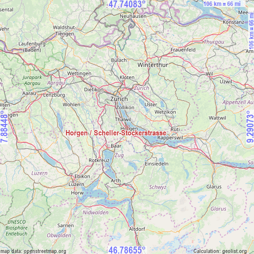
47° 15' 57.024" North, 8° 35' 15.36" East
| Map corner | latitude | longitude |
|---|---|---|
| Upper-left | 47.74083°, | 7.88448° |
| Center: | 47.26584°, | 8.5876° |
| Lower-right: | 46.78655°, | 9.29073° |
| Map W x H: | 106.1×106.1 km | = 65.9×65.9mi |
| max Lat: | 47.76737° ⇑46.3% North |
| Horgen / Scheller-Stockerstrasse: | 47.26584° |
| min Lat: | ⇓53.7% South 45.83203° |
| min Long | Horgen / Schell | max Long |
| 5.97153° | 8.5876° | 10.44624° |
| W 65.1%⇐ | ⇒34.9% E |
Elevation
Elevation of Horgen / Scheller-Stockerstrasse is 422 m = 1385 ft, and this is 136.2 m = 447 ft below average elevation for this country.
| Max E: |
1845 m = 6053 ft | 79.7% |
| Avg. | 558.2 m = 1831 ft | |
| Horgen / Scheller-Stockerstrasse | 422 m = 1385 ft | |
Min E: |
197 m = 646 ft | 20.3% |
See also: Switzerland elevation on elevation.city.
Geographical zone
Horgen / Scheller-Stockerstrasse is located in North temperate zone (between Tropic of Cancer and the Arctic Circle). Distance of this North polar circle is 2145.7 km =1333.3 mi to North.| Distance of | km | miles | from Horgen / Scheller-Stockerstrasse |
|---|---|---|---|
| North Pole | 4751.6 | 2952.5 | to North |
| Arctic Circle | 2145.7 | 1333.3 | to North |
| Tropic Cancer | 2649.5 | 1646.3 | to South |
| Equator | 5255.5 | 3265.6 | to South |


Nearby cities:
15 places around Horgen / Scheller-Stockerstrasse: (largest is in red/bold)
• Feldmeilen
2.9 km =1.8 mi,  60°
60°
• Herrliberg
3.4 km =2.1 mi,  36°
36°
• Horgen
1 km =0.6 mi,  131°
131°
• Horgen / Allmend
2.5 km =1.6 mi,  145°
145°
• Horgen / Horgen (Dorfkern)
1.5 km =0.9 mi,  135°
135°
• Horgen / Käpfnach
2.3 km =1.4 mi,  123°
123°
• Horgen / Oberdorf
0.9 km =0.6 mi,  167°
167°
• Oberrieden
1.2 km =0.7 mi,  323°
323°
• Oberrieden / Berg
1.6 km =1 mi, 315°
• Oberrieden / Mitte
0.9 km =0.6 mi, 322°
• Oberrieden / See
1.1 km =0.7 mi,  337°
337°
• Thalwil
3.4 km =2.1 mi,  327°
327°
• Thalwil / Dorfkern
3.2 km =2 mi, 329°
• Thalwil / See
3.4 km =2.1 mi, 336°
• Thalwil / Süd
2.5 km =1.6 mi, 327°
Sources, notices
• [Note1] Compared only with cities in Switzerland existing in our database
• [Src1] Map data: © OpenStreetMap contributors (CC-BY-SA)
• [Src2] Other city data from geonames.org with taken over terms of usage.
• [Src3] Geographical zone / Annual Mean Temperature by Robert A. Rohde @ Wikipedia
