Herrliberg geodata
Herrliberg (Zurich) is a populated place; located in Switzerland in Europe/Zurich (GMT+2) time zone. With population of 5,025 people, there are 342 cities with bigger population in this country. Compared to other cities in Switzerland, 57% of cities are located further ↓South; 67.5% of cities are located further ←West and 60% of cities have lower elevation than Herrliberg. Note1


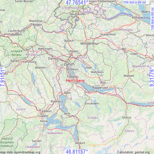
Herrliberg GPS coordinates[2]
47° 17' 26.304" North, 8° 36' 52.704" East
| Map corner | latitude | longitude |
|---|---|---|
| Upper-left | 47.76541°, | 7.91151° |
| Center: | 47.29064°, | 8.61464° |
| Lower-right: | 46.81157°, | 9.31776° |
| Map W x H: | 106.1×106.1 km | = 65.9×65.9mi |
| max Lat: | 47.76737° ⇑43% North |
| Herrliberg: | 47.29064° |
| min Lat: | ⇓57% South 45.83203° |
| min Long | Herrliberg | max Long |
| 5.97153° | 8.61464° | 10.44624° |
| W 67.5%⇐ | ⇒32.5% E |
Elevation
Elevation of Herrliberg is 519 m = 1703 ft, and this is 39.2 m = 129 ft below average elevation for this country.
| Max E: |
1845 m = 6053 ft | 40% |
| Avg. | 558.2 m = 1831 ft | |
| Herrliberg | 519 m = 1703 ft | |
Min E: |
197 m = 646 ft | 60% |
See also: Switzerland elevation on elevation.city.
Geographical zone
Herrliberg is located in North temperate zone (between Tropic of Cancer and the Arctic Circle). Distance of this North polar circle is 2142.9 km =1331.5 mi to North.| Distance of | km | miles | from Herrliberg |
|---|---|---|---|
| North Pole | 4748.8 | 2950.8 | to North |
| Arctic Circle | 2142.9 | 1331.5 | to North |
| Tropic Cancer | 2652.3 | 1648.1 | to South |
| Equator | 5258.2 | 3267.3 | to South |


Nearby cities:
15 places around Herrliberg: (largest is in red/bold)
• Erlenbach
1.9 km =1.2 mi,  316°
316°
• Erlenbach / links des Dorfbachs oberhalb Bahnlinie
1.4 km =0.9 mi, 315°
• Erlenbach / links des Dorfbachs unterhalb Bahnlinie
1.9 km =1.2 mi,  306°
306°
• Erlenbach / rechts des Dorfbachs oberhalb Bahnlinie
2 km =1.2 mi,  333°
333°
• Erlenbach / rechts des Dorfbachs unterhalb Bahnlinie
2.5 km =1.6 mi, 311°
• Feldmeilen
1.4 km =0.9 mi,  158°
158°
• Horgen / Scheller-Stockerstrasse
3.4 km =2.1 mi,  216°
216°
• Küsnacht / Allmend
3 km =1.9 mi, 334°
• Küsnacht / Heslibach
3.2 km =2 mi, 321°
• Meilen
3.1 km =1.9 mi,  130°
130°
• Oberrieden
3.3 km =2.1 mi,  236°
236°
• Oberrieden / Mitte
3.3 km =2.1 mi,  232°
232°
• Oberrieden / See
3 km =1.9 mi, 233°
• Thalwil / See
3.4 km =2.1 mi,  276°
276°
• Thalwil / Süd
3.5 km =2.2 mi,  259°
259°
Sources, notices
• [Note1] Compared only with cities in Switzerland existing in our database
• [Src1] Map data: © OpenStreetMap contributors (CC-BY-SA)
• [Src2] Other city data from geonames.org with taken over terms of usage.
• [Src3] Geographical zone / Annual Mean Temperature by Robert A. Rohde @ Wikipedia
