Richterswil / Richterswil (Dorfkern) geodata
Richterswil / Richterswil (Dorfkern) (Zurich) is a section of populated place; located in Switzerland in Europe/Zurich (GMT+2) time zone. With population of 3,292 people, there are 533 cities with bigger population in this country. Compared to other cities in Switzerland, 52.4% of cities are located further ↑North; 74.6% of cities are located further ←West and 67.9% of cities have higher elevation than Richterswil / Richterswil (Dorfkern). Note1
Current local time in Richterswil / Richterswil (Dorfkern):
06:19 AM, SaturdayDifference from your time zone: hours


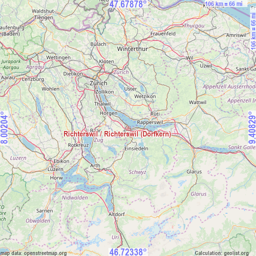
Richterswil / Richterswil (Dorfkern) GPS coordinates[2]
47° 12' 11.628" North, 8° 42' 18.576" East
| Map corner | latitude | longitude |
|---|---|---|
| Upper-left | 47.67878°, | 8.00204° |
| Center: | 47.20323°, | 8.70516° |
| Lower-right: | 46.72338°, | 9.40829° |
| Map W x H: | 106.2×106.2 km | = 66×66mi |
| max Lat: | 47.76737° ⇑52.4% North |
| Richterswil / Richterswil (Dorfkern): | 47.20323° |
| min Lat: | ⇓47.6% South 45.83203° |
| min Long | Richterswil / R | max Long |
| 5.97153° | 8.70516° | 10.44624° |
| W 74.6%⇐ | ⇒25.4% E |
Elevation
Elevation of Richterswil / Richterswil (Dorfkern) is 441 m = 1447 ft, and this is 117.2 m = 385 ft below average elevation for this country.
| Max E: |
1845 m = 6053 ft | 67.9% |
| Avg. | 558.2 m = 1831 ft | |
| Richterswil / Richterswil (Dorfkern) | 441 m = 1447 ft | |
Min E: |
197 m = 646 ft | 32.1% |
See also: Switzerland elevation on elevation.city.
Geographical zone
Richterswil / Richterswil (Dorfkern) is located in North temperate zone (between Tropic of Cancer and the Arctic Circle). Distance of this North polar circle is 2152.7 km =1337.6 mi to North.| Distance of | km | miles | from Richterswil / Richterswil (Dorfkern) |
|---|---|---|---|
| North Pole | 4758.6 | 2956.9 | to North |
| Arctic Circle | 2152.7 | 1337.6 | to North |
| Tropic Cancer | 2642.6 | 1642 | to South |
| Equator | 5248.5 | 3261.3 | to South |


Nearby cities:
15 places around Richterswil / Richterswil (Dorfkern): (largest is in red/bold)
• Bäch
2 km =1.2 mi,  87°
87°
• Feusisberg
3.7 km =2.3 mi,  119°
119°
• Freienbach
4 km =2.5 mi, 86°
• Richterswil
0.7 km =0.4 mi,  297°
297°
• Richterswil / Burghalde
1.3 km =0.8 mi, 304°
• Richterswil / Dorfkern
0.4 km =0.2 mi,  8°
8°
• Samstagern
2.2 km =1.4 mi,  233°
233°
• Schindellegi
3.2 km =2 mi,  168°
168°
• Wollerau
1.4 km =0.9 mi,  131°
131°
• Wädenswil
3.8 km =2.4 mi,  313°
313°
• Wädenswil / Boller-Giessen
2.6 km =1.6 mi,  321°
321°
• Wädenswil / Dorf (Wädenswil)
3.8 km =2.4 mi, 319°
• Wädenswil / Eichweid
2.9 km =1.8 mi, 306°
• Wädenswil / Leihof-Mühlebach
3.4 km =2.1 mi, 311°
• Wädenswil / Untermosen-Fuhr
4.2 km =2.6 mi, 310°
Sources, notices
• [Note1] Compared only with cities in Switzerland existing in our database
• [Src1] Map data: © OpenStreetMap contributors (CC-BY-SA)
• [Src2] Other city data from geonames.org with taken over terms of usage.
• [Src3] Geographical zone / Annual Mean Temperature by Robert A. Rohde @ Wikipedia
