Wollerau geodata
Wollerau (Schwyz) is a populated place; located in Switzerland in Europe/Zurich (GMT+2) time zone. With population of 6,883 people, there are 232 cities with bigger population in this country. Compared to other cities in Switzerland, 53.2% of cities are located further ↑North; 76% of cities are located further ←West and 60.3% of cities have lower elevation than Wollerau. Note1


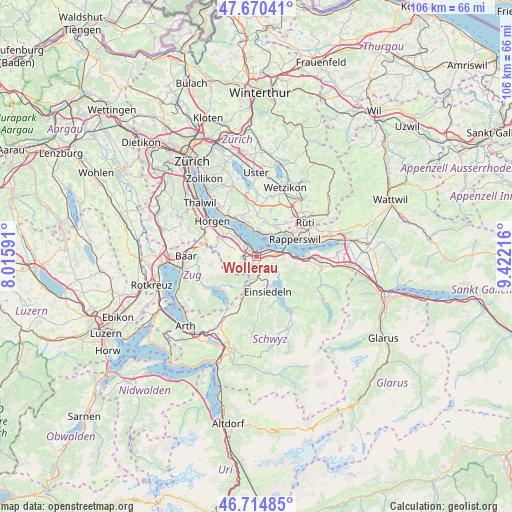
Wollerau GPS coordinates[2]
47° 11' 41.208" North, 8° 43' 8.508" East
| Map corner | latitude | longitude |
|---|---|---|
| Upper-left | 47.67041°, | 8.01591° |
| Center: | 47.19478°, | 8.71903° |
| Lower-right: | 46.71485°, | 9.42216° |
| Map W x H: | 106.2×106.2 km | = 66×66mi |
| max Lat: | 47.76737° ⇑53.2% North |
| Wollerau: | 47.19478° |
| min Lat: | ⇓46.8% South 45.83203° |
| min Long | Wollerau | max Long |
| 5.97153° | 8.71903° | 10.44624° |
| W 76%⇐ | ⇒24% E |
Elevation
Elevation of Wollerau is 520 m = 1706 ft, and this is 38.2 m = 125 ft below average elevation for this country.
| Max E: |
1845 m = 6053 ft | 39.7% |
| Avg. | 558.2 m = 1831 ft | |
| Wollerau | 520 m = 1706 ft | |
Min E: |
197 m = 646 ft | 60.3% |
See also: Switzerland elevation on elevation.city.
Geographical zone
Wollerau is located in North temperate zone (between Tropic of Cancer and the Arctic Circle). Distance of this North polar circle is 2153.6 km =1338.2 mi to North.| Distance of | km | miles | from Wollerau |
|---|---|---|---|
| North Pole | 4759.5 | 2957.4 | to North |
| Arctic Circle | 2153.6 | 1338.2 | to North |
| Tropic Cancer | 2641.6 | 1641.4 | to South |
| Equator | 5247.6 | 3260.7 | to South |


Nearby cities:
15 places around Wollerau: (largest is in red/bold)
• Bäch
1.4 km =0.9 mi,  44°
44°
• Dorf
5.1 km =3.2 mi,  14°
14°
• Feusisberg
2.3 km =1.4 mi,  111°
111°
• Freienbach
3.2 km =2 mi,  68°
68°
• Kehlhof
4.7 km =2.9 mi,  18°
18°
• Pfäffikon
4.5 km =2.8 mi,  81°
81°
• Richterswil
2.1 km =1.3 mi,  307°
307°
• Richterswil / Burghalde
2.7 km =1.7 mi, 308°
• Richterswil / Dorfkern
1.7 km =1.1 mi,  324°
324°
• Richterswil / Richterswil (Dorfkern)
1.4 km =0.9 mi, 311°
• Samstagern
2.8 km =1.7 mi,  262°
262°
• Schindellegi
2.3 km =1.4 mi,  190°
190°
• Wädenswil / Boller-Giessen
4 km =2.5 mi, 317°
• Wädenswil / Eichweid
4.3 km =2.7 mi, 308°
• Wädenswil / Leihof-Mühlebach
4.8 km =3 mi, 311°
Sources, notices
• [Note1] Compared only with cities in Switzerland existing in our database
• [Src1] Map data: © OpenStreetMap contributors (CC-BY-SA)
• [Src2] Other city data from geonames.org with taken over terms of usage.
• [Src3] Geographical zone / Annual Mean Temperature by Robert A. Rohde @ Wikipedia
